
Why Iran adventure tours – IRAN TRAVEL, TRIP TO IRAN
|
|
Why Iran adventure tours
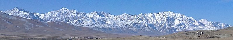
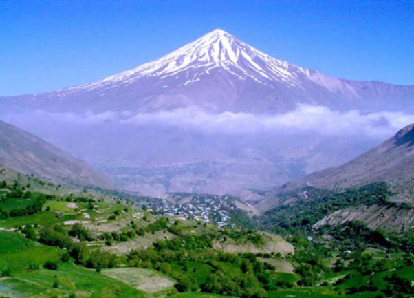
More than half of this vast land is covered with mountains with different heights.
In general, Iran Mountains are located in two large and long stretched mountain chains of Alborz & Zagrous. There are also numbers of Isolate Mountains around situated in Iran central deserts, a brief description of the above-mentioned chains and the isolated mountains of central desert are explained below:
ALBORZ MOUNTAIN RANGE
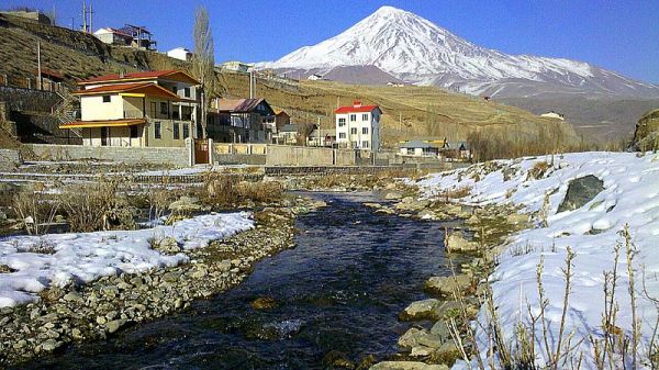
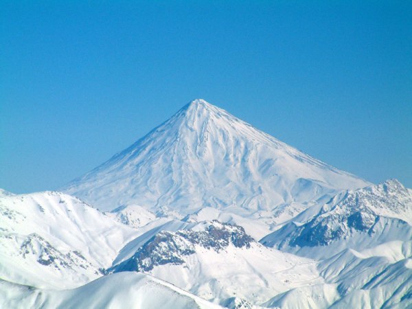
The name of Damavand has been repeated many times in the ancient Iranian myths and legends. In all of them it has been tried to describe Damavand with glory and strength. In one of the most famous legends it has been written that when Turians captured a part of ancient Iran, after sometime they realized it is difficult for them to govern and rule their new captured region and bet if an Iranian could shoot an arrow from his homeland to the farthest point in Turan, that point would be considered as the new border between Iran and Turan. To make this new point, Arash (the famous epic hero) who was the best arrow shooter at that time, climbed the peak and with all the love he had in this heart to his country, shoot the arrow with all his strength to the farthest point in Turan. After he shoot the arrow, all his strength was exhausted from his body and filled in the arrow which landed on the farthest point in Turanians country.
Damavand is a volcanic peak, when reaching the top, the climbers could see and also walk in the crater. The circumference of this crater is 450 m and it is covered with snow all the year.
 |
When reaching the peak and looking to the west, Lar dam, Tehran and surrounding mountains are visible. Among other things that could be seen on the top are the corpses of some sheep died after reaching the peak which have not lost their shape very much because of the coldness of weather in the top of the mount.
Sulfur Hill
About 500 m left to reach the peak, there is a place called Sulfur hill or Dood Kooh which is the result of latest volcanic activities of this mount. This area is covered with Sulfur stones. In summers when the sun shines on them, sulfur gases rises from the stones, this is why that area is called Sulfur hill. The sulfur gas smells like a spoiled egg that may cause some irritation in the eyes and throat.
 |
Abshar-e-Yakhi Waterfall
In the southern route of Damavand and before reaching the Sulfur hill, in the altitude of 5000 m, there is a frozen waterfall named Abshar-eYakhi (7 m high) which never melts. This frozen waterfall does not flow to any river. In warm seasons of the year when the upper frozen snow begin melting, the coldness of weather and wind prevent the melting of snow of this waterfall. This is why this waterfall is always frozen.
Damavand Climate
The speed of wind in Damavand region sometimes reaches even to 150 km per hours. Most of the winds blow from the west and the northwest, which causes considerable raining in this area.
The average annual rainfall in this region is 1400 mm; this is why the rivers of this area are filled with water nearly throughout the year.
 |
Water Resources
Because of high amount of raining, Damavand region does not face with the problem of shortness of water, but in comparison with other regions, Damavand cannot be put among other mountains, which has considerable amount of water. The temperature of soil in Damavand is three times warmer than other mountains; this is why the snow melts very soon in this region.
Air Pressure
Route Name of Area Air Pressure mm/Hg
Northern First shelter 550
Northern Second shelter 490
Southern Masdjed 610
Southern Barghah-e-Sevom 540
Southern Abshar-e-Yakhi 480
Southwest Simorgh hut 540
Northeast Takht-e-Fereydoon hut 530
— Damavand Peak 465
— Sea level 760
 |
Damavand Springs
Normally Damavand springs could be seen in the altitudes of lower than 3500 m. Several of its high altitude springs are seasonal. From 4000 m up to the peak there is not any spring, so the only source for obtaining water from 4000 up to the peak is water of snow.
Damavand wildlife
Animals such as fox, jackal and wolf can be found around Damavand. Those animals can also be seen up to the altitude of 4000 m. Because of the existing of forests in the northern part of this region, bears are found mostly in the northern forests and they avoid going to the high altitudes.
In these region animals such as goat, ewe, eagle, a kind of gazelle, boar and rabbit are also found in that region. Except boar and rabbit which live in the fields of Damavand other above mentioned animals live in the high altitudes in the warm seasons of the year, and when the weather become cold they come down to the lower altitudes. Those animals may climb up to 5000 m as well.
In Damavand region about 5 different types of snakes, scorpion, lizard and mouse can be found.
Damavand Glaciers
The most important glaciers of Damavand are:
– Two large glaciers of Sioleh and Dobi Sel in the northen of Damavand
– The famous glacier of of Yakhar in the northeast of Damavand which has been climbed many times in summers, but noone has already climbed it in winter.
– Western glaciers which do not have a particular name
 |
Damavand Routes:
Damavand has 6 main routes and a number of side routes to climb, its main routes are:
Southern route, Northen route, Eastern route, Western route, Northeast route
Damavand Shelters:
In the altitude of 4100 m in the southern route, there is a shelter called “Bargah-e-Sevom” which holds about 30 people, it is also possible to camp near the shelter.
In the altitude of 4600 m of the northeast route there is a shelter called “ Takht-e-Fereydoon” which holds 30 people, it is possible to camp near this shelter as well.
In the western route and in the altitude of 4000 m there is a newly built shelter named “ Simorgh” .
In both altitude of 4000 and 5000 m of the Northern route there are two huts, each hold about 15 people, but there is no possibility to camp near those huts.
In the ancient Persian language AL OR HAR meant (long) and so Borz meant (mountain).
This chain is stretched more than 950 km from northeast to northwest and along the Caspian Sea which is largest lake of the world. The width of this chain varies from 25 km to 110 km. This long chain is connected through mountains of northern Khorasan to Hendo Kosh Mountains in Afghanistan.
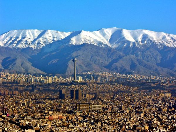
The height of Alborz in its eastern and western parts is between 2,500 m to 3,000 m. While in its central part (located in the southern of the Caspian sea) since the width of this chain increases, more high altitude peaks are also seen in this part.
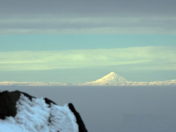
The highest peak in this mountain chain is DAMAVAND (5,671 m) volcanic peak which lies in northeast of the central Alborz.
This great chain separates the Caspian Sea from central desert of Iran which results in different climatic conditions in those two regions as well as variety in grass covering, for this reason the northern part of this chain is green and covered with lush forests and its south part is rather dry and covered with bushes.
 |
ALBORZ SUB RANGES
This chain has many ranges stretching from 30 km to more than 200 km suitable for hiking and strong and demanding mountaineering, some of theses ranges are: Takht-e-Soleyman, Central Alborz, etc.
Alborz Highest Peaks
Here are some of high altitude peaks of this great chain in its central part:
– Kholenou (4,375 m)
– Kooloon Basteh (4,200 m)
– Shah Alborz (4,200 m)
– Sarak Chal (4,150 m)
– Azad Kouh (4,370 m)
– Alam Kouh (4,845 m)
– Shakhak-e-Alam (4,740 m)
– North Khersan (4,670 m)
– Marjikesh (4,520 m)
And in Takht-e-Soleyman part:
– Takht-e-Soleyman (4,650 m)
– Alam Kouh (4,850 m)
 |
DENA MOUNTAIN RANGE
Dena Mountain Range with over 50 km length is situated in northwest part of Shiraz and from geographical view it is stretched from northwest to southeast; between Isfahan and
Kohkiloyeh Boir-e-Ahmad provinces.
Dena range consists of eastern, central and western ridges. A pass called Bijan (3,200 m) separates eastern ridge from central ridge; in not snowy times; this pass can be covered by car. Because of the geographical situation of eastern part, which makes the snow melts rarely, the glaciers are found almost all the time in this part of the range, while in the western part some big walls could bee seen.
Dena range enjoys more than 40 peaks each with an altitude of over 4,000 m. “Bijan 3” (4,450 m) is known as the highest peak of this range.
The mountains of this region are calcareous and because of this many fossils are found in this region.
Dena Suitable Climbing Time
• Climbing on Dena ridges:
If the snowfalls have been considerable in winter: from mid July until mid September
If less snowy winters: from mid June until mid September.
• Individidual peaks of Dena Range
The best time for climbing individual peak in this range is from mid May until mid September.
Dena water Resource
Springs could be hardly found in the high altitudes of this range, but it is possible to make use of the water results from snow melting.
Dena Plant Covering
In different altitudes of the southern foot of this range the following covering are seen:
• Up to the altitude of 2,500 m, Oak forests
• Up to the altitude of 3,500 m, small trees of wild plum and almond
• Up to the altitude of 4,000 m, bush
Dean Wildlife
This region’s wildlife consists of some wild animals such as brown bear, partridge, different specious of eagles, vulture, wolf, panther and wild goat.