A brief translation of the famous Swedish explorer and geographer, Sven Anders Hedin’s words in his book written about Iran’s deserts in 1905:
The desert with its wondrous magical power lures me in. My heart wants to rush to it and listen to the great silence that rides like a cloud on its surface. The freedom and solitude was mine to grab in the depths of the desert. Here, among the leafless trees, there was an eternal and imaginative silence dominantly present; this silence was calling me to an endless desert.
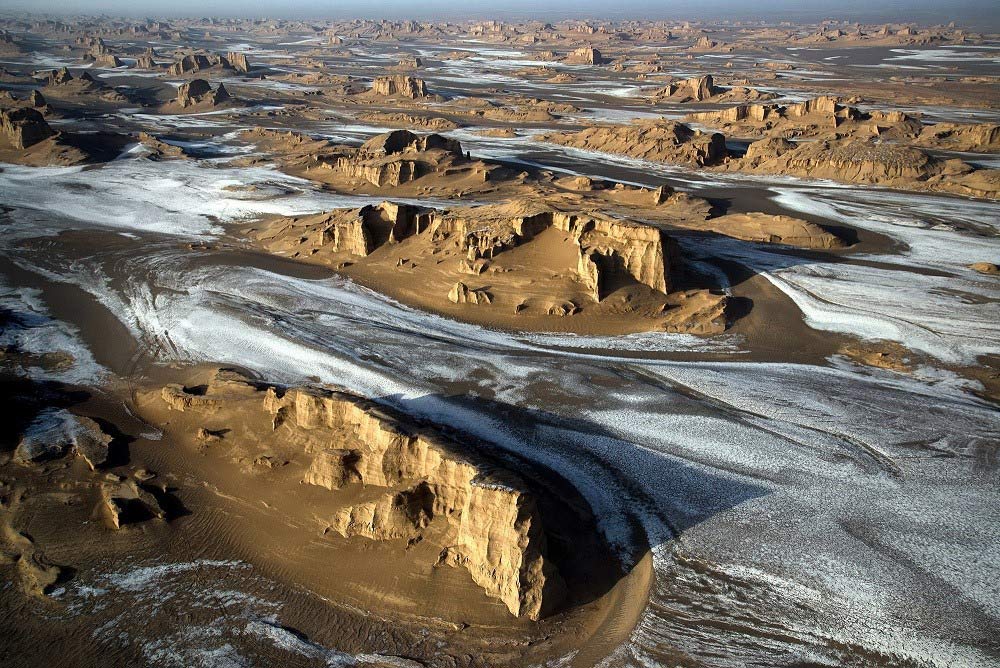
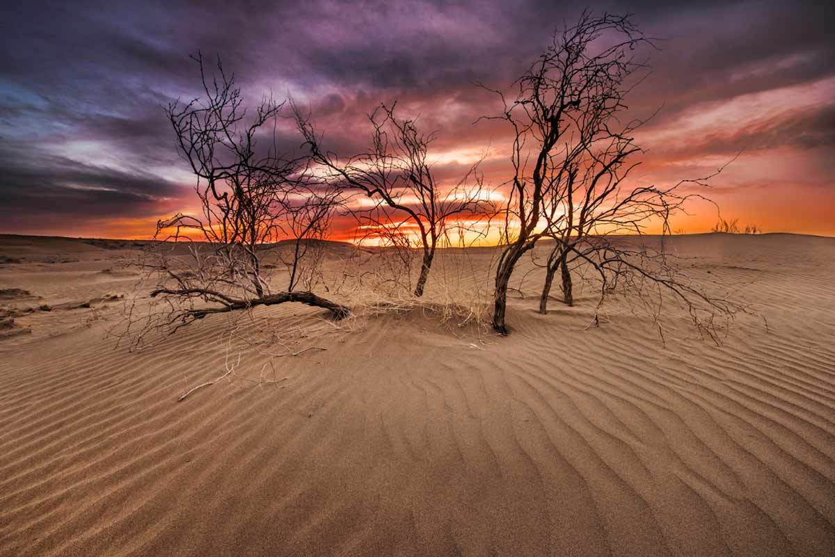
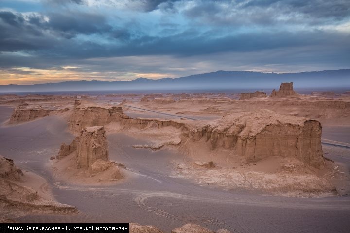
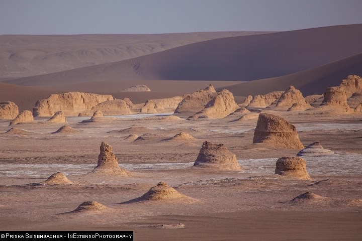
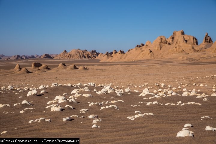
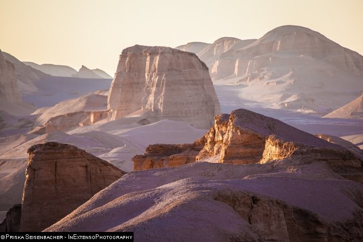
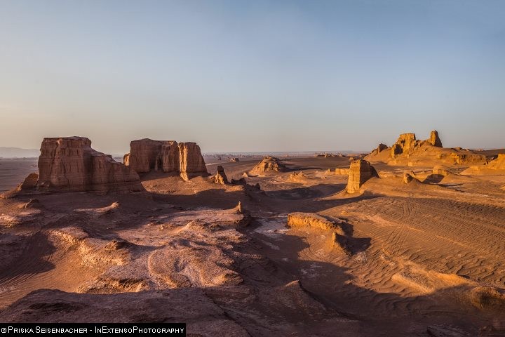
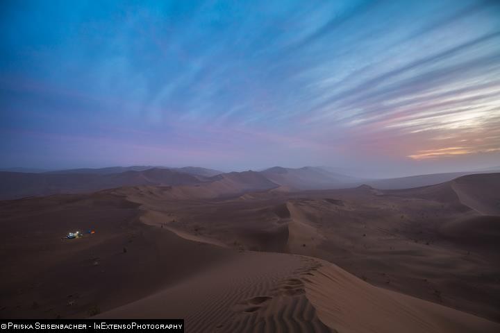
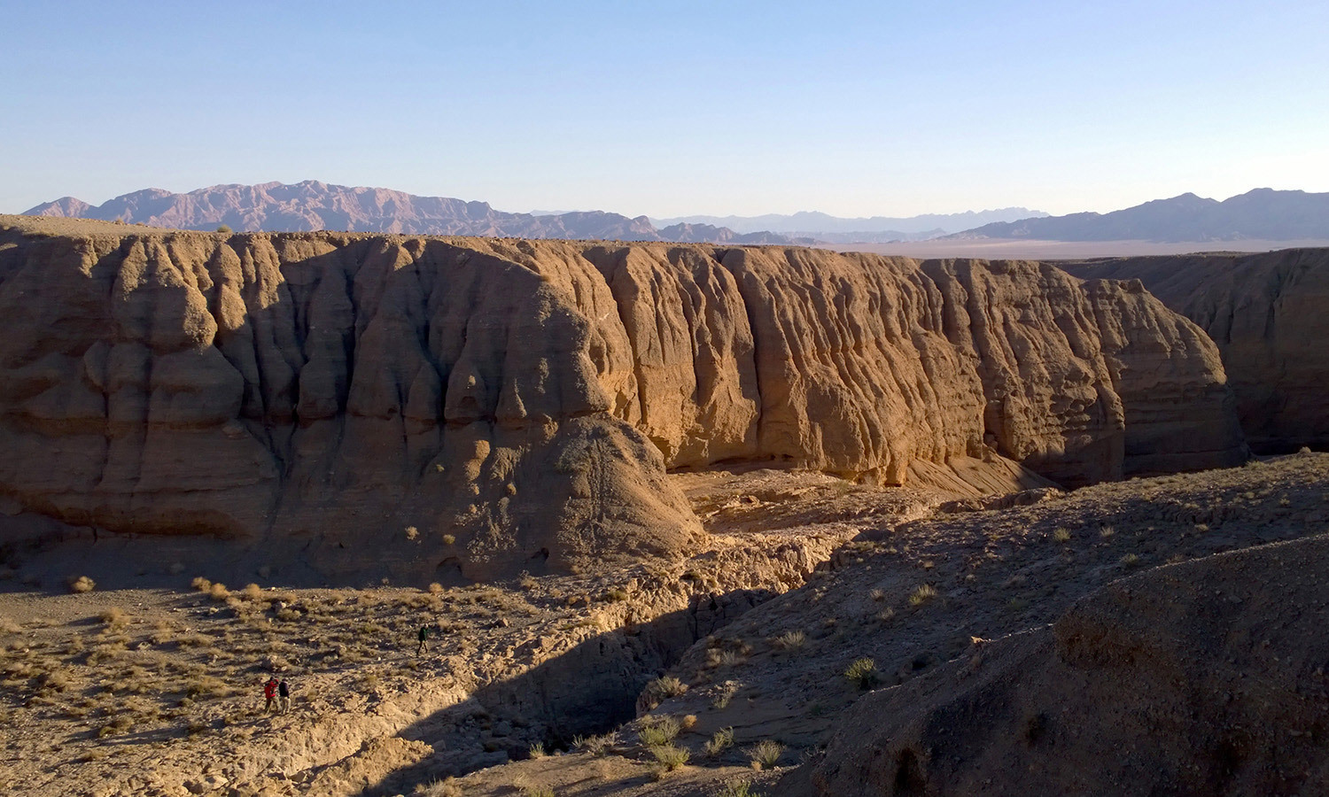
Lut Desert, Kalouts
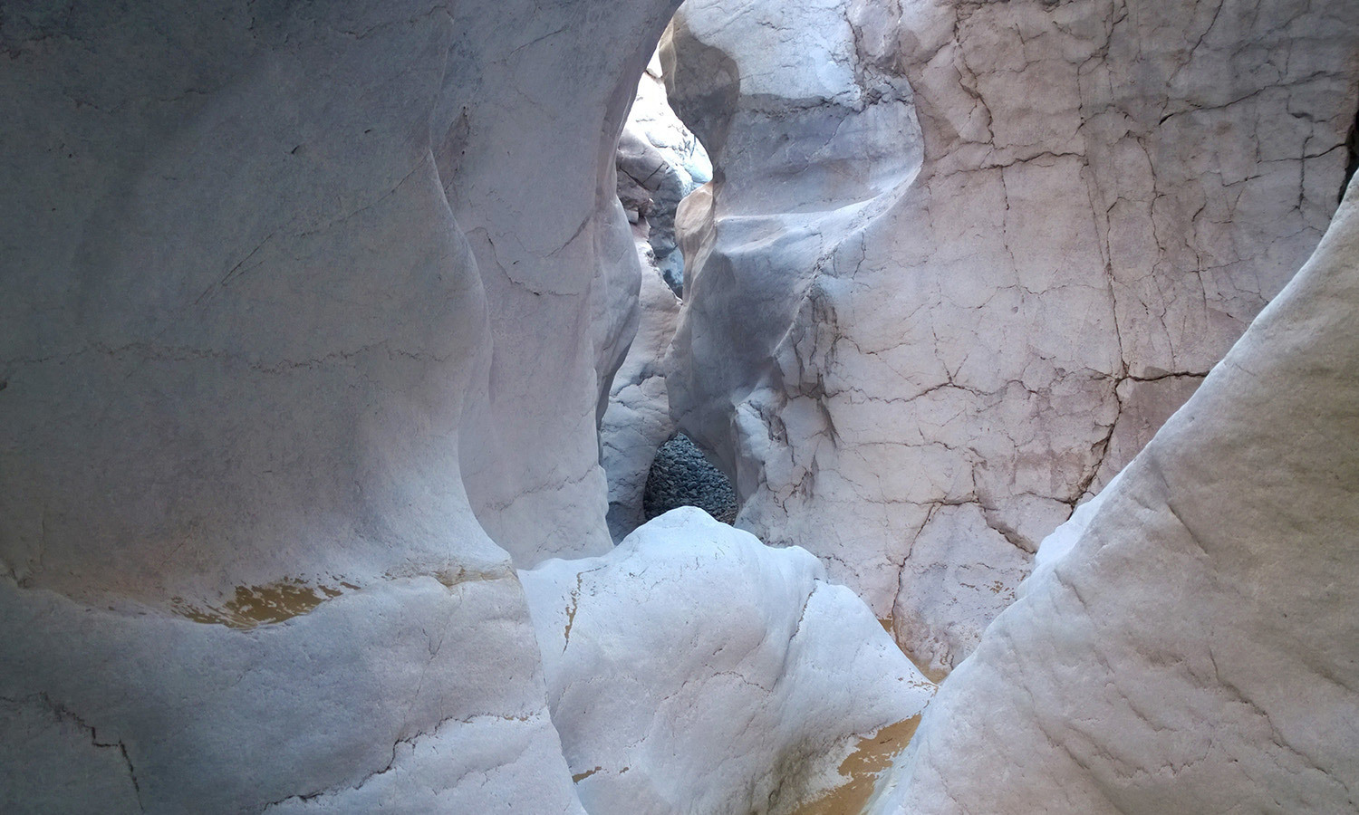
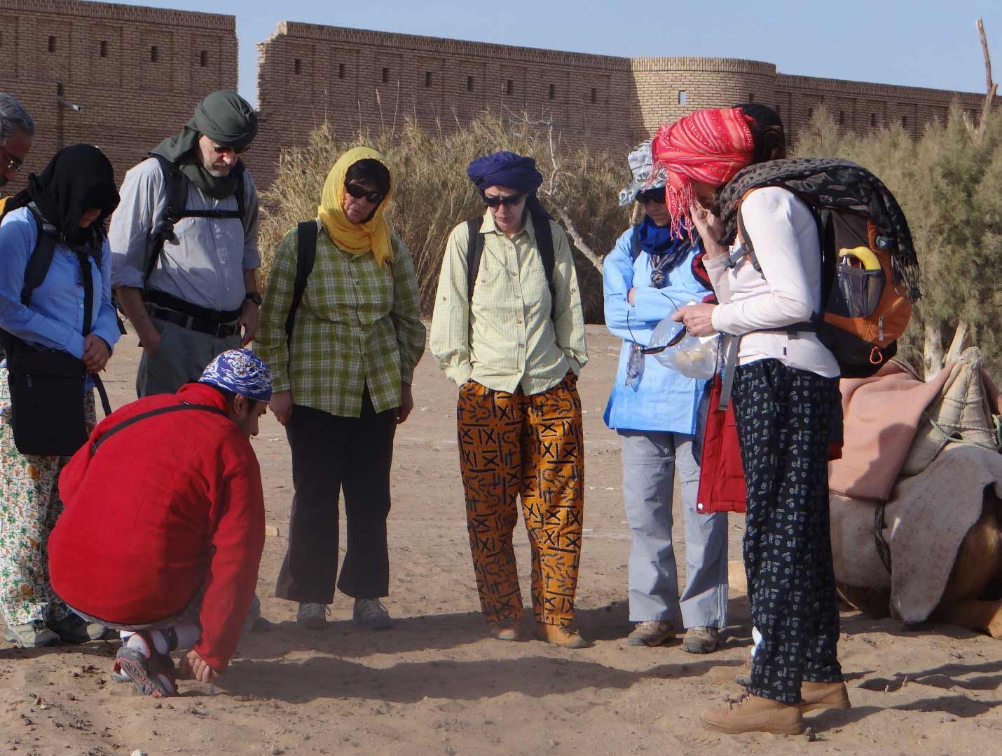
Stepping into these truly fantastic remote places, will show you breathtaking landscapes created by wind erosion, a unique desert flora and fauna, salt lakes, salt crystal polygons, golden sand dunes, beautiful hot sunny days and starry night sky in mystical silence, all of which come hand in hand to create a lifelong memory. There are varieties of desert attractions spread out through the country. Each with their own beauty and wonders to offer.
Iran has vast deserts forming almost 25 percent of its land. There are two main deserts, Dasht-e Lut, UNESCO World Heritage, located in the Southeast of Iran, and Dasht-e Kavir, in the middle of Iranian plateau, which are among the most interesting and at the same time, one of the least explored parts of the country.
Other than Lut and Central Desert, these two major properties, there are other salt lands, which can be found in most parts of the country, except for the wetlands. Desert lands, depending on the areas in which they are located, can be divided into four groups.
1- Semi-arid such as Kaboodan Desert in East Azerbaijan Province, Mahabaad Desert in West Azerbaijan and Miqan Desert in the central province. 2- Arid, such as Hoz-e Soleyman, Masileh and Maranjab in Qom province. 3- Semi desert, such as Saqand, Abarkuh, Marvast and Chah-e Afzal of Ardakan in Yazd province. 4- Desert, such as Kevirs or salty desert parts of Lut desert, which have created a magnificent plant-less scenery, bearing the unique salt crystals in different shapes and forms such as polygons and blisters as far as the eye can see.
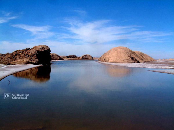
Lut Desert, Salt River (Rood Shoor)
The sand dunes located in East part of Lut Desert locally called Rig-e-Yalan is a marvelous natural destination that stands out the most amongst all. Considering a vegetation encompassing sandstone plants such as stipagrostis plumosa, haloxylon and calligonum distinguishes the scattered flora in this area. Rig-e-Yalan animal species includes rüppell’s fox, indigenous birds of the desert area and falcons.
Salt lakes like Khoor, Maranjab and Hoz-e Soltan are amongst the popular natural attractions of Iran Deserts. Hoz-e Soltan (means ruler’s pond) Lake located near Qom is a seasonal Salt Lake, resembling a gigantic natural mirror as its shallow water covers a vast plain of salt deposits. The lake is said to be a suitable place for breeding a kind of shrimp, called Armita. Best timing for visiting this lake starts from late autumn through early spring.
- National parks & protected areas:
Kevir National Park, the Preserved Area of Khar-Touran and Kalmand & Bahadoran Protected Zones are amongst the most famous protected areas located in Iran deserts. They come together in bearing some endemic species.
There are some valuable endemic species such as Zagh e Boor, Asian cheetah and Asian Zebra in Khar-Touran.
Kevir National Park is among the biosphere reserves of the world. This national park is home to some unique wildlife species including, Persian Onager, Asiatic Cheetah, Leopard, Striped Hyena, Caracal, Beech Marten, Flamingo and even Ruddy Shelduck.
The Kalmand & Bahadoran Protected Zones in Yazd province encompass diverse species of vegetation and animals; to name a few, bustard, Iranian gazelle, and Jeibir.
- Some of the main Urban and Rural Destinations of Iran’s Deserts:
the tall Wind Towers of Dowlat Abaad Garden, Yazd Province
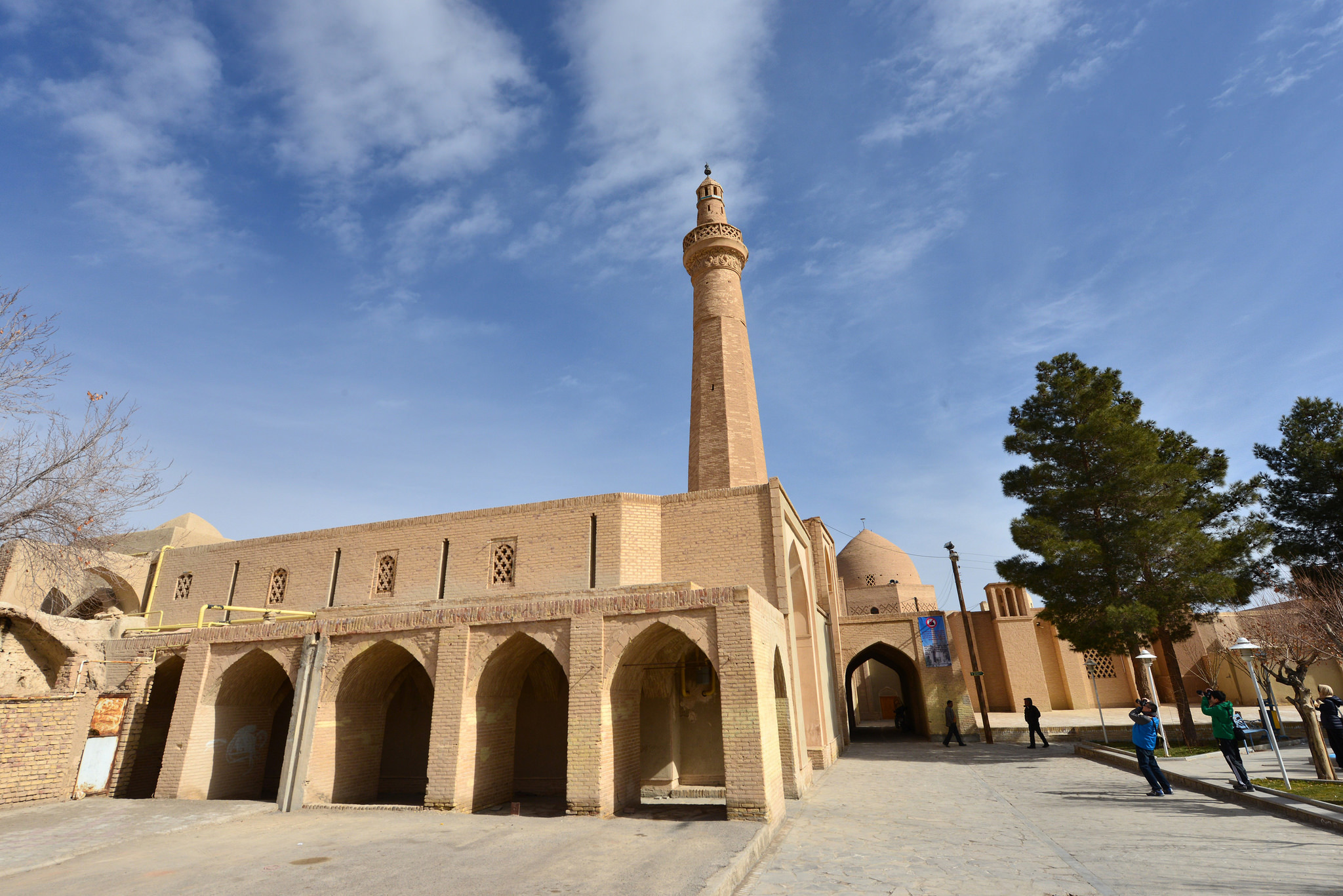
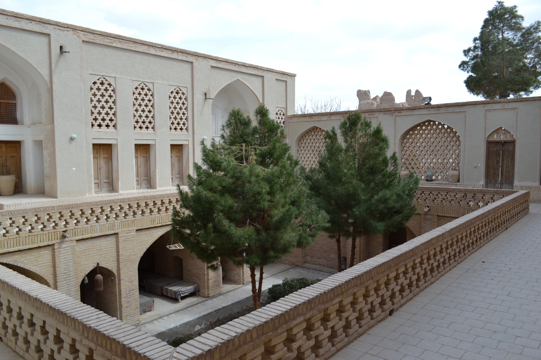
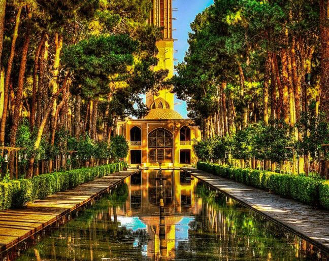
- Yazd: One of the main desert cities of Iran, close to spice and silk roads, is Yazd. Many tourists visit Yazd every year for its unique environment and desert style architecture. Yazd is known as the city of wind towers. A fair point worth mentioning is that it has been recognized as a UNESCO WORLD HERITAGE (2017); it has gained the title of the Mud-Brick City. A trip to this city is going to teach you all you ever wanted to learn about life in desert cities and how people adapt to the special environment of their hometown.
- Kashan: Let us resume with the city of Golab (Rose water) and the birthplace of famous Iranian artists, Kashan, which is one of the oldest cities in Iran. Tourism Capacity, Natural and Historical spots and variety of climates attracts every visitor. Kashan has some breathtaking highlights. For instance the lavish Fin Garden, UNESCO World Heritage Site. A historical legacy that contains the famous Fin Bath belonging to the long list of Persian Gardens, Agha Bozorg Mosque & School and historical Tabatabaeiha , Borujerdiha and Ameriha Houses. The details and special features of the architecture is truly a treat for the eyes.
- Kerman: Next, Kerman, anciently known as Carmania, where the human settlement dates back to almost 4thmillennium BC. This city is rich in historical and cultural legacies, which you will come across in every twist and turn, like the old wall surrounding the city or the traditional icehouses, wind towers, etc. Not to mention Ganj Ali Khan Complex, a massive and magnificent complex including a vast variety of buildings and structures composing of a school square, caravanserai, public bath, mosque and covered bazaar with many handicrafts to offer, including traditional copper dishes.
- Mahan: Last but not least, Mahan, which is well known for the tomb of the great Sufileader Shah Ne’emat Ollah-e-Vali, as well as Shazdeh Garden (Prince Garden), WORLD HERITAGE SITE. The tomb of Shah Nur-eddin Nematollah Vali, poet, sage, Sufi and founder of an order of dervishes, has twin minarets covered with turquoise tiles from the bottom up to the cupola.
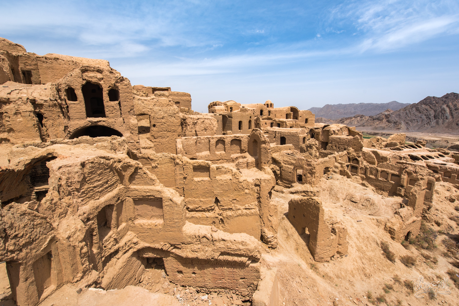
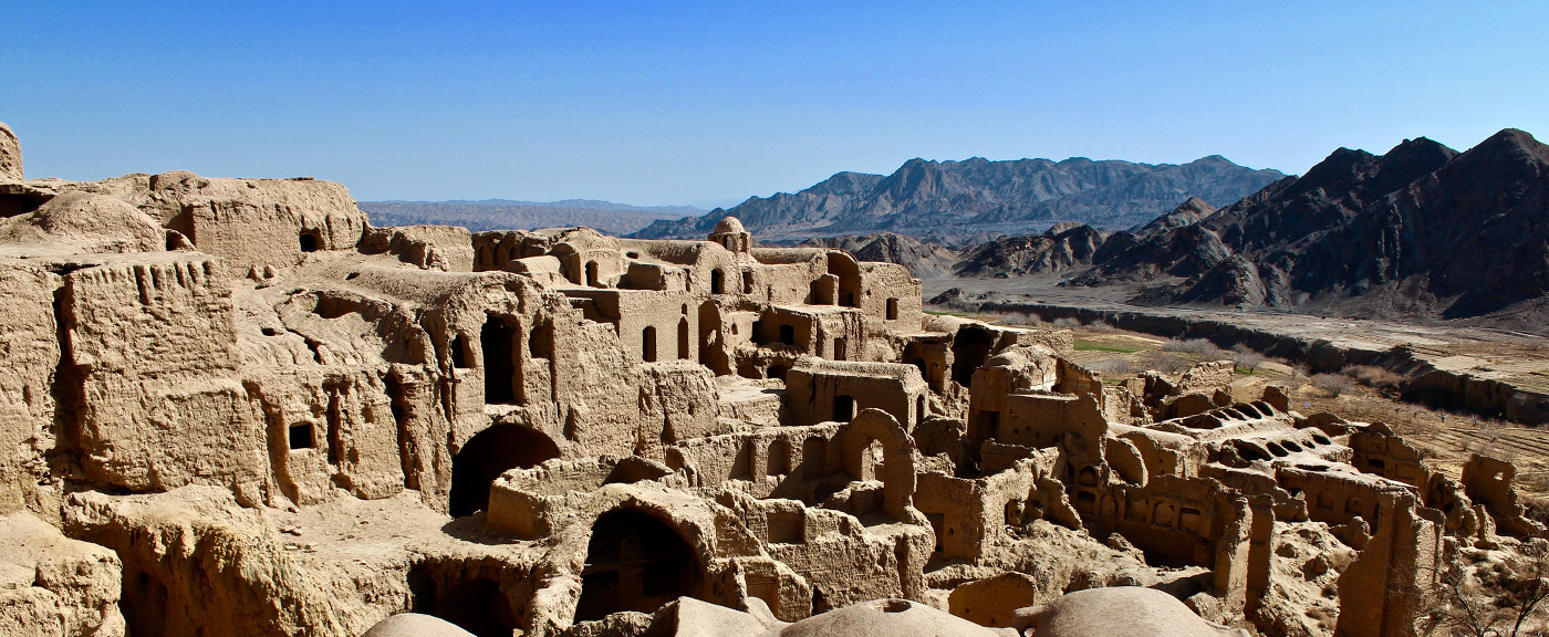
- Visitors top desert towns & villages: There are also some villages and towns worth mentioning like Mesr, Farahzad, Bayazeh, Arusan, Anarak, Iraj, Khoor& Biyabanak, Jandagh, varzaneh, Ashin, Abozyd Abaad and Mehrjan. Each offering their own uniqueness and similarities that they share.
- Top special destinations and activities of Iran’s deserts:
Some of the most popular destinations in terms of Desert Adventure in Iran are Lut Desert and Dasht-e Kavir. The names that will ring a bell the most are probably Maranjab, Mesr and Abozyd Abaad.
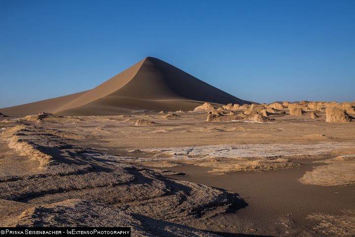
- Lut Desert:
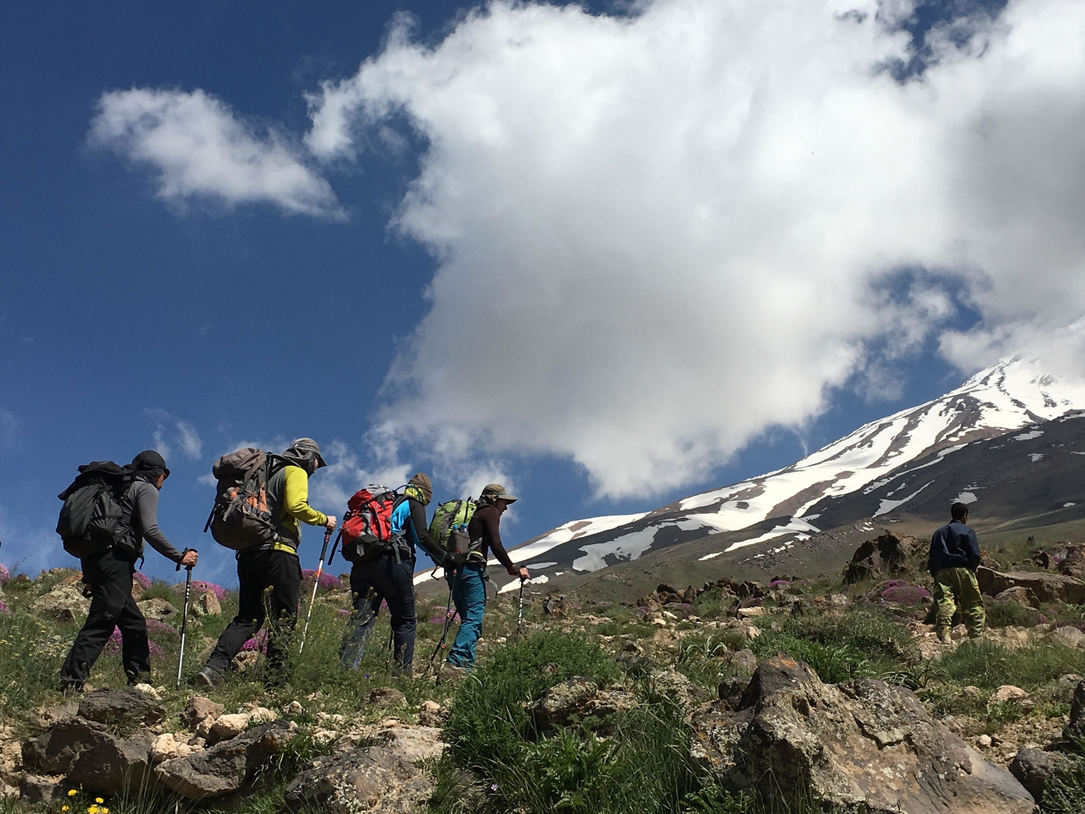
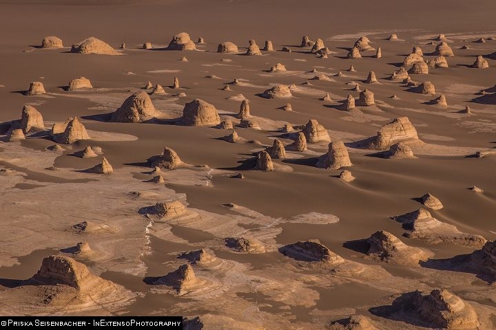
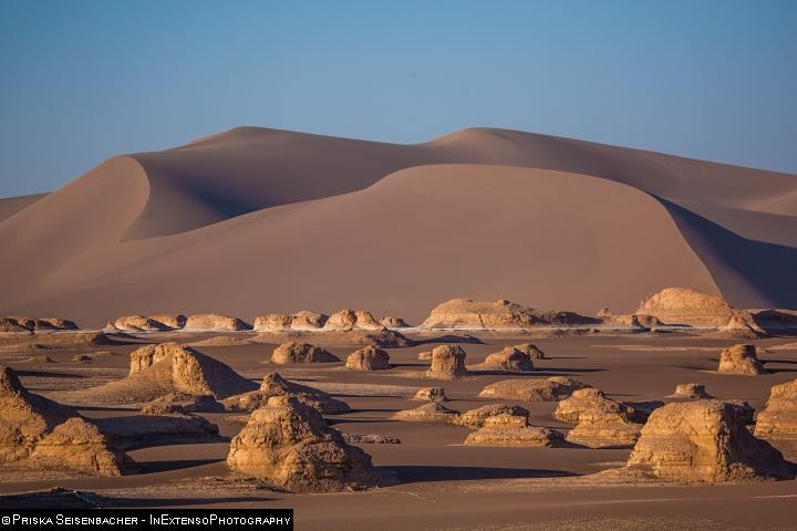
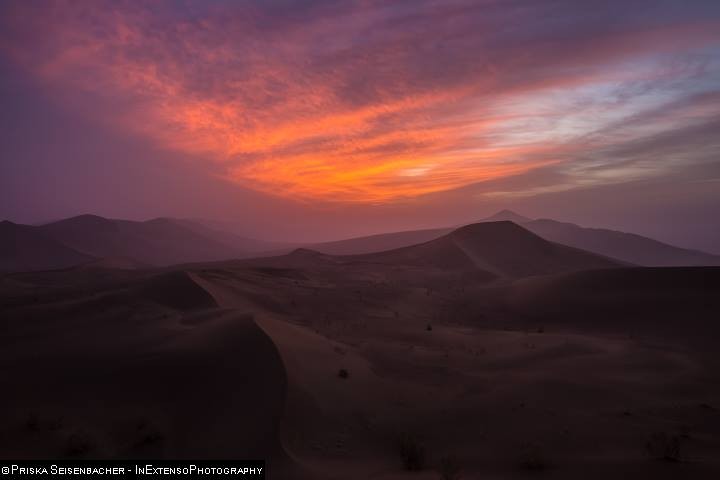
The first and the most famous desert among tourists is Lut Desert or Dasht-e-Lut, UNESCO WORLD HERITAGE SITE, which forms one of the vast desert areas in Iran, located in south east of the country. In Persian Lut means bare and due to its lack of water and vegetation, it has earned the name, Lut. This area is divided into northern, central and southern parts. Kerman, Khorasan and Sistan-Baluchestan provinces form part of the surrounding areas of this desert. This arid and high temperature area is guarded by mountains, in a sense that whilst walking on an arid and bare desert you can have the contrasting view of snowcapped mountains. According to annual reports, among some years, this desert has had the record of one of the hottest places on earth: a temperature of 70.7 C. It is an arid subtropical desert renowned for a massive variety of different and beautiful landforms. This area is rich with its own flora and fauna adapted to harsh natural conditions. There are lots of settlements in forms of villages (approximately 28 villages) particularly on the western edge, including Shahdad and the surrounding areas. A mesmerizing natural feature of Lut Desert is Yardang, with the local name of Kalout; Resembling sand castles in different sizes and forms. Looking from a distance, you will see the mirage of a desert city with skyscrapers scattered around it. However, they are actually Yardangs, created along thousands of years by wind and water erosion. All these unique landmarks come hand in hand to form an exceptional desert area with spectacular geomorphological beauties, which led to this desert being registered as a UNESCO WORLD HERITTAGE SITE.
Rig-e Yalan, Lut Desert
Rig-e Yalan on the east side of Lut Desert and Hamada Plain in central Lut, as well as Yardangs on the west, are the most beautiful sceneries of Lut Desert, turning it into a luxuriously untouched and pristine destination.
Another natural feature of Lut Desert is its vegetation of Nebka, which has graced this desert with its one of a kind beauty. The plant that forms on top of these Nebkas are called the local name of Gaz. take years to develop and beside their beauty they keep the moisture of the soil and acts as a barrier against sand movement, which keeps the area from tuning into a complete dry land. In comparison to the Nebkas in Libya and Sahara of Africa, the ones in Lut Desert, Iran are much higher and sometimes grow up approximately 12 meters.
Some other beauties of this desert which capture the visitors’ eyes are some land forms scattered in shapes of salt polygons, tepee fractured, small salt blisters and gypsum dunes.
The seasonal Salty River that flows into the desert from the northern part, is another paradox natural beauty of Lut.
A safari trip through this land and camping at night to watch the sunset from among the Yardangs will be forever engraved in your memory.
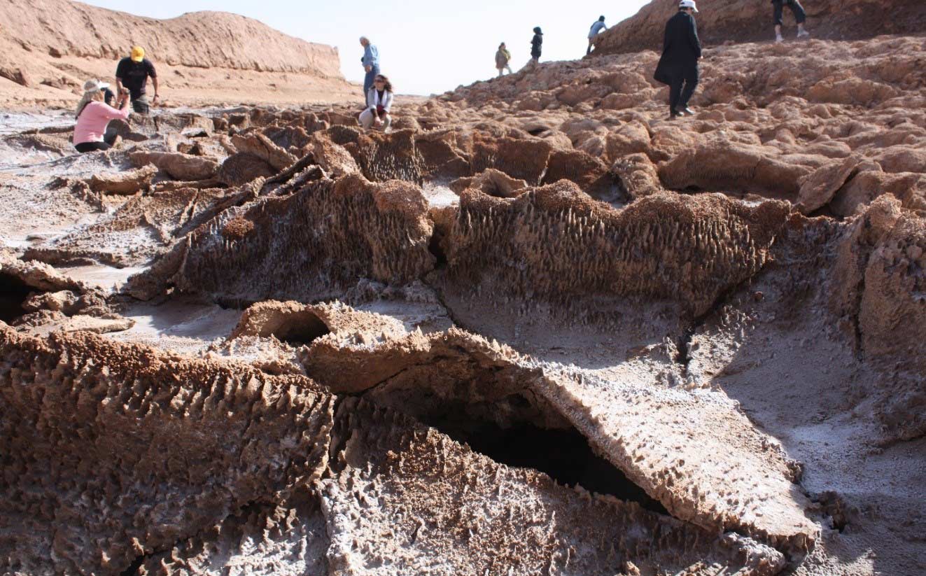
Lut Desert, Salt Crystals
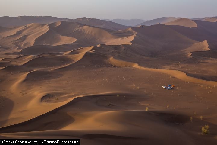
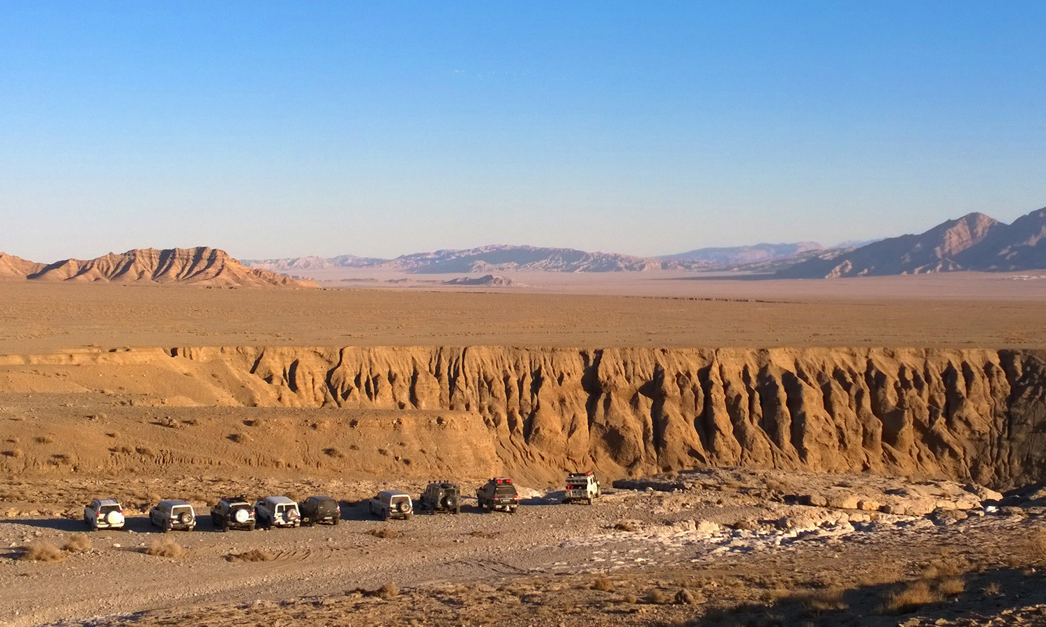
- Dasht-e Kavir (Central Desert):
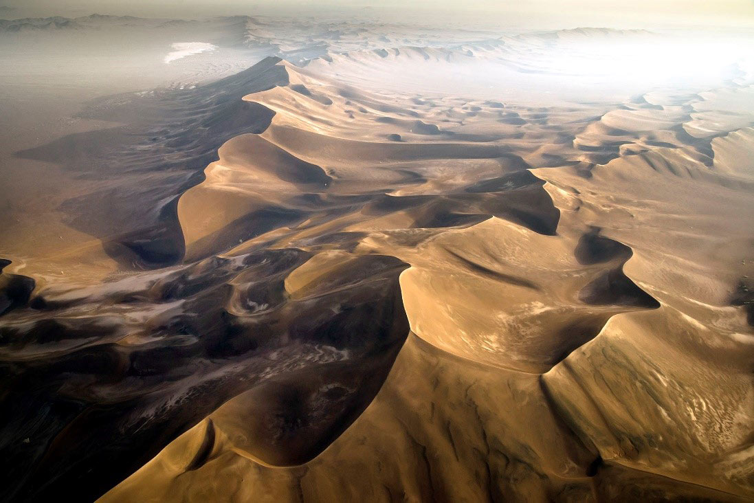
Dasht-e Kavir or the Central Desert, the vastest desert of Iran located in the middle of the Iran plateau, stretches from the southern face of Alborz Range to Jandaq Mountains in Isfahan Province. This desert is surrounded by Khorasan, Semnan and Isfahan provinces. Some marsh areas are scattered on the surface of this desert. On the outer edges, some sandy hills and high land could be seen scattered.
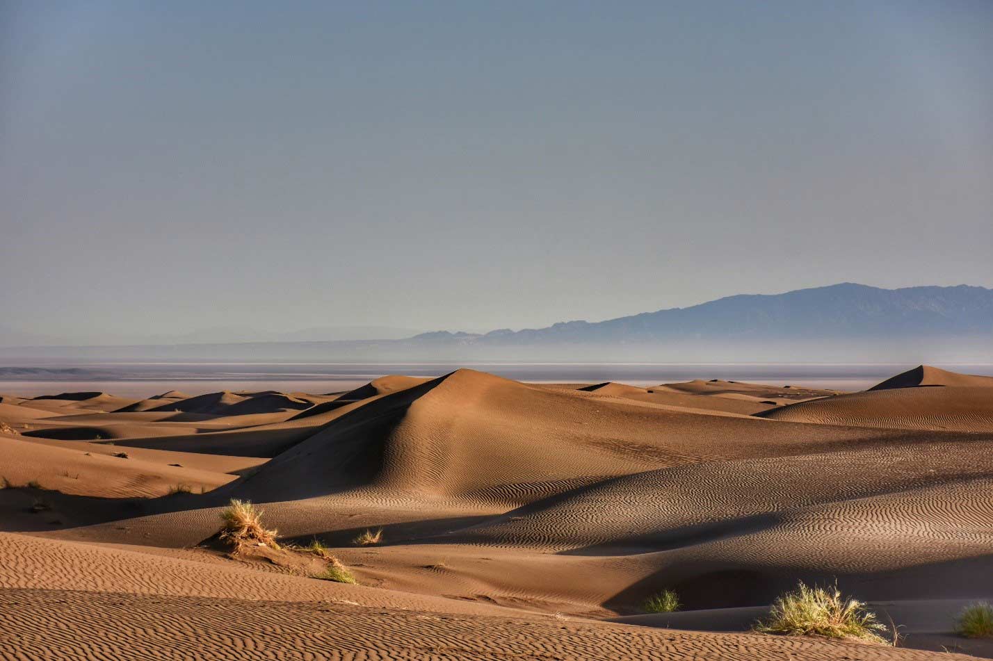
Dasht-e Kavir, sandy dunes
A desert road worth bringing up, as it cannot be compared to any other road in Iran deserts, is the dreamy road passing through the heart of Dasht-e Kavir, with its mysterious desert silence. It starts from Damghan City in the North and ends to “Jandagh” town in the South. Driving along this desert road, you will experience unique views and mesmerizing mirages.
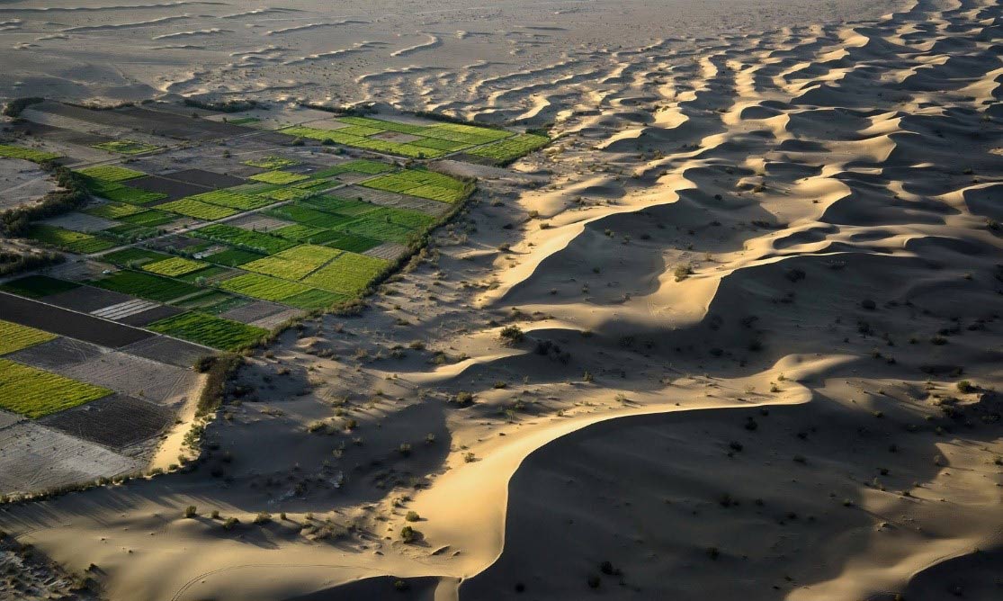
When you enter the desert from Northside, you arrive to beautiful unexpected green villages like Rasham, Moaleman and Husseinian and after a journey through these villages, your eyes meet these colorful hills called Sar-Kevir (the beginning of kevir), which are staked like color pencils beside each other. By walking on these hills you would be amazed, when you fix your eyes upon the endless desert horizon. At the end of this vast desert you will be welcomed by the beautiful saffron fields of Jandaq.
Farahzad Village, Mesr Desert, Dasht-e Kavir
Dasht-e Kavir is a mix of sand and salt. Against the odds, oases exist within these desolate environs, home to villages that are sustained by the wells of sweet water.
- Kavir National Park:
An important part of the central desert is Kavir National Park, known as “Little Africa”, 440,000 hectares. A protected ecological zone. This park includes a flat desert and steppe landscapes.
This protected and ecological park in Iran is for travelers who are looking for a safari-like wildlife. It is Located in the central desert, home to the rare wildlife species such as Asian Zebra, wild goats, Eagles, falcons and so on. This natural reserved park bears fascinating historical monuments such as Qasr-e-Bahram Caravanserai, Nahr-e-Sangi and Sang-Farsh.
Speaking of which, one of the dazzling accommodations of this area is Qasr-e-Bahram or Siyah Kouh caravanserai. The outward appearance is made of polished pink stones, which is one of its unique features. On The northern part of Qasr-e-Bahram, lies the stone pavement or Sang-Farsh, also known as the Shah Abbas way, which is also a part of the Silk Road.
A unique feature of the desert area is its water supply system. The stone water channel is one of the masterpieces of water supply in desert areas, which is provided the required portable water for Qasr-e-Bahram, from a spring with bitter water called Shah Spring. The channel was made by joining long stone units to each other.
Natural phenomena of the Kavir National park are countless. However, if we were going to mention one above all, that would be Namak Lake or Salt Lake, which sits outside the parks boundaries. As there is very minimum, rainfall in this area, the lake is mostly a salt marsh. However, it has created an amazing scenery.
Dasht-e Kavir, Maranjab Desert
- Maranjab Desert:
Another amazing part of Dasht-e Kavir (Central Desert), which is definitely worth a stop, is Maranjab Desert. A mesmerizing combination of natural wonders and a popular desert destination in Isfahan province. Mainly because there are, so many different activities, to do in Maranjab, camel riding, desert biking, safaris and so on. This dazzling desert is stretched endlessly in northeast of Aran va Bidgol, covered by eye catching sand dunes and linked to Kavir National Park.
Maranjab Caravanserai
Maranjab Desert provides you with a unique stay in a historical caravanserai located in the middle of the desert. Maranjab Caravansary is situated on one of silk roadside roads, built under Shah Abbas command in 1604. Looking at the vast desert landscape from hilltops, you may be lucky to see the wandering lake, which seems to appear in different places throughout a day.
The stunning Salt Lake of Maranjab is one of the most beautiful landscapes of the desert. It is actually a salt marsh. Water flows into the lake from Qom River. Centuries of salt deposit, carried by salty water of rivers and floods has created this magnificent site. Dazzling white salt crystal polygons surround the Lake’s surface. This lake currently is being used to extract salt from. It has an amazing view during the sunset.
The wondering island of Maranjab Desert is amongst some of the most magical attractions of Iran, as there has always been a saying that this island is constantly moving. Looking at it from a distance, this place looks like a ship in a sea of sand. Especially at night, this view can truly make you forget about reality and step right into a fantasy world.
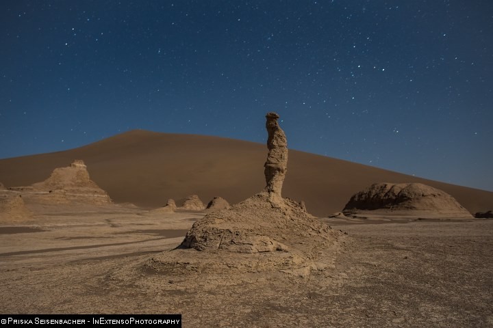
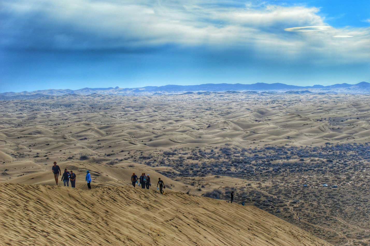
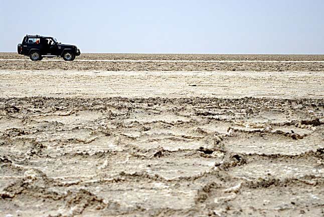
Dasht-e Kavir, Kalout safari tour
The name “Maranjab” literally implies: “Do not be hurt due to thirst, heat, wind and dust of desert, as water pool and desirable shadow of trees await you.”

Polygons, Salt River
- Mesr Desert:
The next part of the central desert worth mentioning for sure is none other than Mesr Desert, a village and desert area in Jandaq Rural District, in the Central District of Khur and Biabanak County, far east of Isfahan Province. Mesr is basically 420 km far from Isfahan city, and 371 km far from Yazd. After passing Farokhi and Nasrabad villages.
This desert may be a bit different in terms of scenery as it is partly a village and holds exotic traditional houses. These houses will be your shelter at night and they have become quite popular between culture enthusiasts. Camel riding and safaris are the type of activities that can also take place in Mesr Desert. It is one thing to walk around in the desert and explore, but it is quite another, riding a camel and taking in the view. A very well-known attraction of this desert is the Khur Salt Lake, shaped by salt remains with the local name of “Kavir e Tabagheh”, a place that truly shouldn’t be missed. The network-shaped salt polygons are covering the surface for as far as the eye can see. This salt lake is located near Mesr Desert and Khur & Biabank area.
These forms turn black in winter due to mixing with clay and in the summer, they are white due to the intensity of evaporation.
The golden back to back sandy dunes of Mesr Desert with its green flora trailing through the dunes crevices, could be a unique experience and certainly an enjoyable one for those who are visiting this desert for the first time.
The view of date palm trees in the surrounding villages of Mesr Desert is one of the most beautiful sceneries of desert regions of Iran.
Let’s not forget that the experience of watching the sunset in the majestic scenery is none like other.
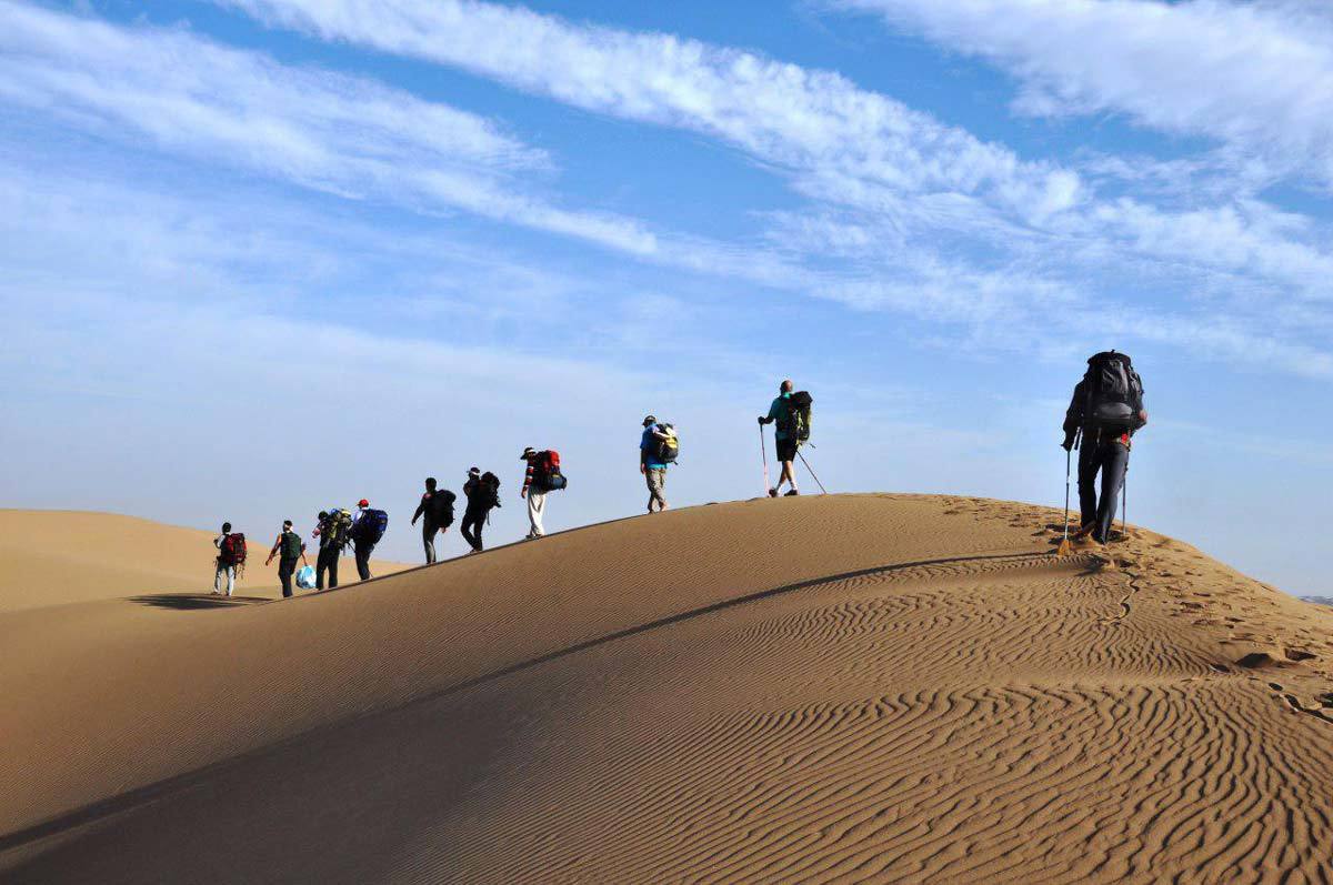
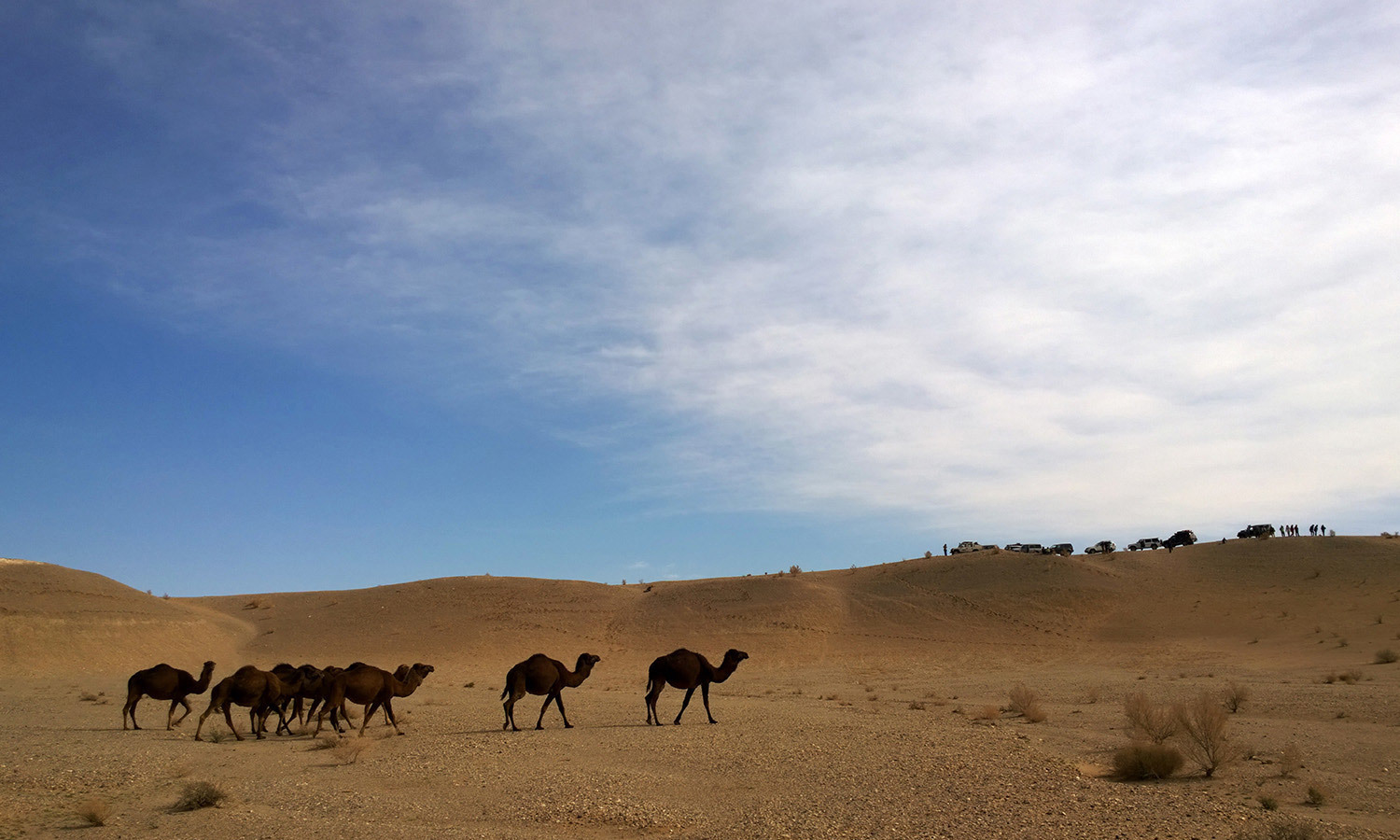
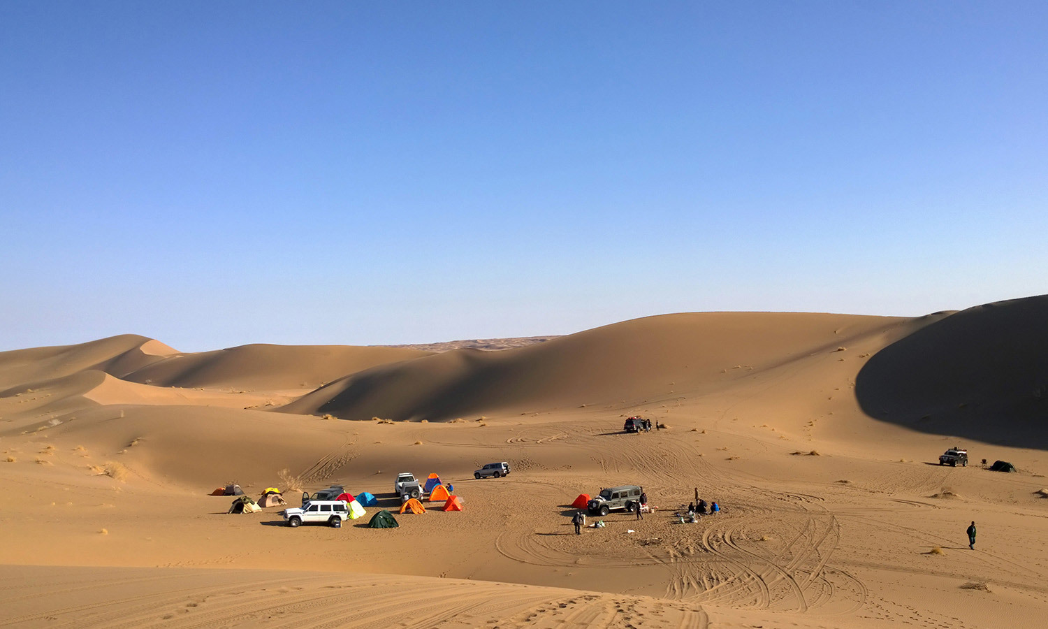
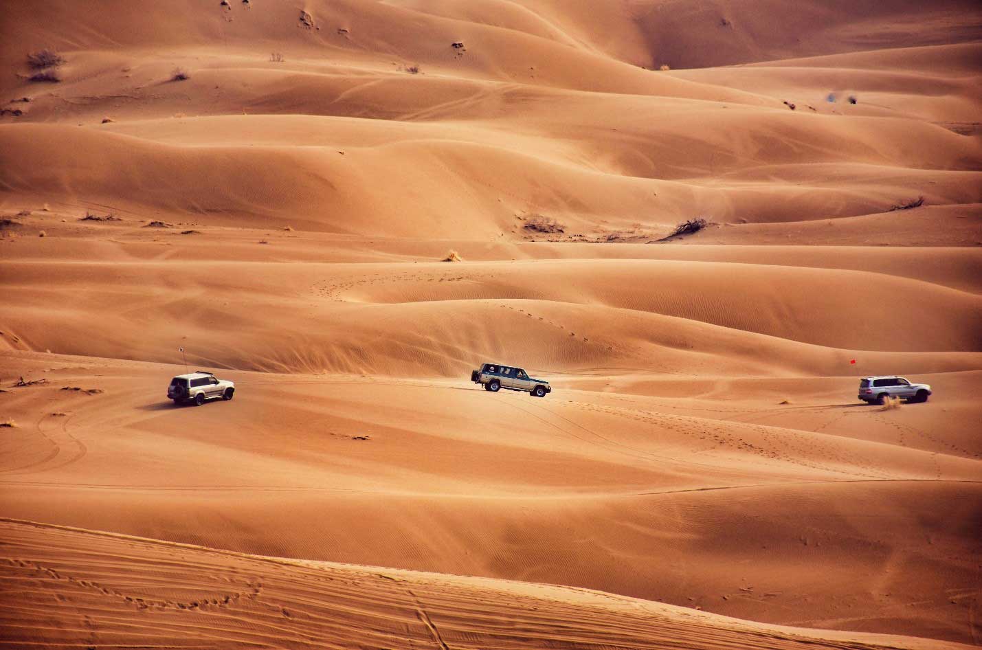
In all these areas you can have the chance to go horseback riding, camel riding, desert biking, riding sand motorcycles, four-wheel driving & desert safaris, thermal waters, wildlife and so on. You can take it to the next level by paragliding on a Para motors.
Not to forget thermal waters, health benefits and the incomparable healing features of desert areas. Khur, Dig-e Rostam and Sirch are some of the popular thermal water destinations to visit and swim in desert areas and not to mention the amazing salt polygons. If you ever decided to take a break and hit the road, do not forget to visit Iran and specially Iran’s mystical deserts.
Desert Tours, designed and organized by “Aftab Kalout Tour & Travel Company”( web link ) in Iran, include all different desert travel styles out there. From exiting wildlife safaris, professional desert biking and horseback riding to a relaxed “glamping”, just to watch the stars and chill out in the natural thermal waters. Not everyone has the same taste and we have taken all the tastes into consideration.
Salt River, Maranjab Desert