Elburz Mountains

also spelled Alborz, Albourz, Alburz, or Elburs, Persian Reshteh-ye Kūhhā-ye Alborz,

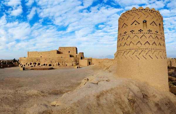
major mountain range in northern Iran, 560 miles (900 km) long. The range, most broadly defined, extends in an arc eastward from the frontier with Azerbaijan southwest of the Caspian Sea to the Khorāsān region of northeastern Iran, southeast of the Caspian Sea, where the range merges into the Ālādāgh, the more southerly of the two principal ranges there. More commonly, however, the westernmost part of the range is called the Talish (Talysh, Talesh, or Tavālesh) Range, or the Bogrov Dāgh. The Elburz Range, in its strictest sense, forms part of the central stretch of the chain, which also includes Iran’s two highest peaks, Mount Damāvand and Mount Alām. The Elburz mountain system traverses virtually all of the northernmost portions of Iran from east to west.

Elburz Mountains

The Elburz chain is not as truly alpine (i.e., resembling the European Alps) in its structure as is often suggested. On the one hand, continental conditions regarding sedimentation are reflected by thick Devonian sandstones (about 360 to 415 million years old) and by Jurassic shales containing coal seams (about 145 to 200 million years old). On the other hand, marine conditions are reflected by strata dating to the boundary of the Carboniferous and Permian periods (about 300 million years old) that are composed mainly of limestones, as well as by very thick beds of green volcanic tuffs and lavas. Orogenic (mountain-building) phases of importance date from the Miocene and Pliocene epochs (between about 23 and 2.6 million years ago). Over large areas they produced only a loose folding; but in the Central Elburz a number of folds were formed into blocks thrust mainly southward but in places northward, with cores made of Paleozoic rocks (more than 250 million years old). Structurally and topographically, the Elburz system is less clearly defined on the southern than on the Caspian (northern) side of the chain, since various off-branching elements interconnect it on the southern side with the adjoining Iranian plateau.

The Western Elburz Range runs south-southeastward for 125 miles (200 km). Varying in width from 15 to 20 miles (24 to 32 km), it consists of a single asymmetric ridge, the long slope facing the Caspian. Few of its peaks approach or exceed 10,000 feet (3,000 metres) in height. There is a low pass west of Āstārā, near the Azerbaijan frontier, 5,000 feet (1,500 m) above sea level. The Safīd River, formed by the junction of the Qezel Owzan (Qisil Uzun) and Shāhrūd rivers, is the only river to cross the whole width of the chain: its gorge, giving access to the low pass of Qazvīn, offers the best passage through the mountain chain, although by no means an easy one, between the Gīlān region on the shores of the Caspian and the inland plateau to the south.

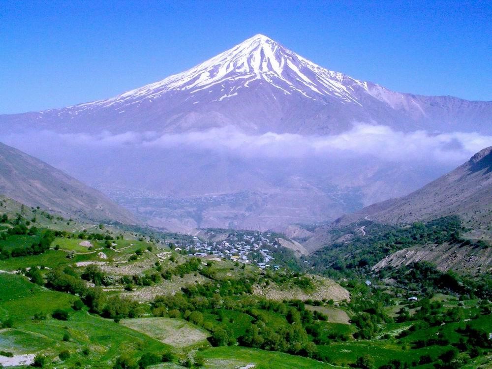
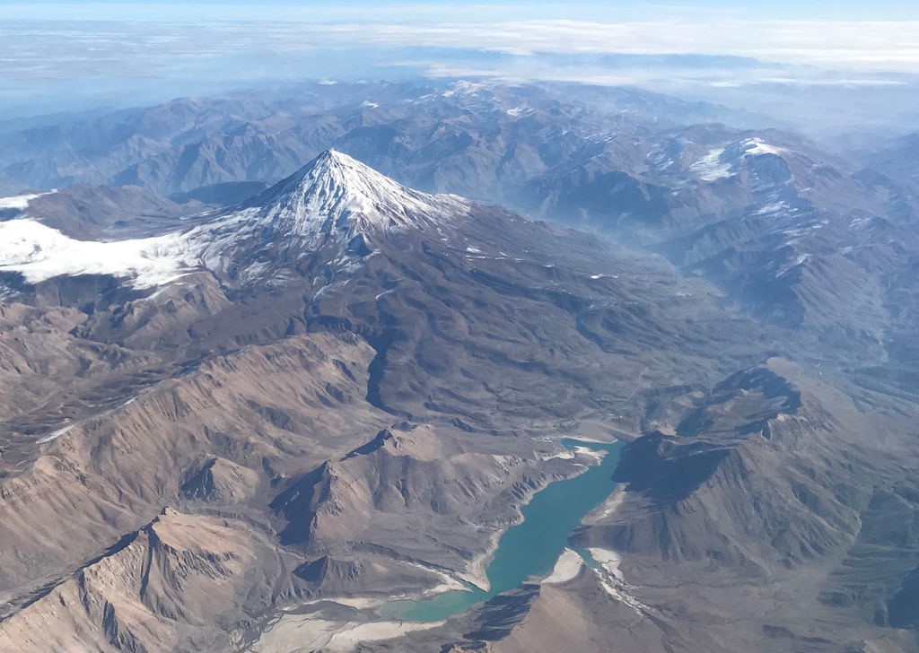
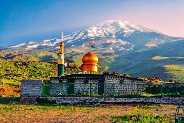
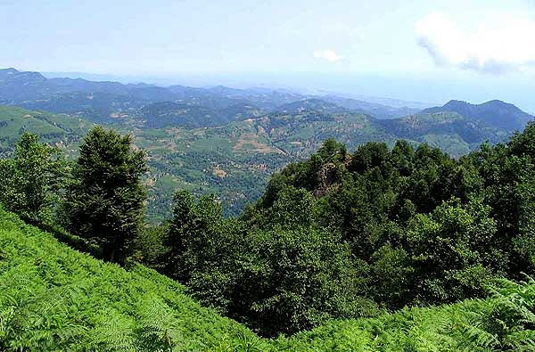
The Central Elburz is 250 miles (400 km) long. East of the longitude of Tehrān, which lies to the south of the range, it reaches a width of 75 miles (120 km). Located among the longitudinal valleys and ridges of the range are some important centres of settlement, with the towns of Deylamān, Razan, Kojūr, and Namar located on the Caspian side and Emāmshahr (formerly Shāhrūd), Lār, Damāvand, and Fīrūzkūh on the southern side. There are likewise many gorges, by which the rivers find their way down one or another of the slopes. Only two passes allow a relatively easy crossing in a single ascent—those are the Kandevān Pass, between the Karaj and the Chālūs rivers, and the Gadūk Pass, between the Hableh and the Tālā rivers. The main divide runs generally south of the highest crest, which—with the exception of the towering and isolated cone of the extinct volcano Mount Damāvand (18,386 feet [5,604 metres])—culminates in the glaciated massif of Takht-e Soleymān, which rises to more than 15,750 feet (4,800 metres).

The Eastern, or Shāhkūh, Elburz runs about 185 miles (300 km) in a northeasterly direction. Since two ranges branch off on its southern side and no compensatory elements appear on the northern side, its width dwindles to less than 30 miles (48 km). With the exception of the Shāhkūh Range proper (which reaches an elevation of 12,359 feet [3,767 metres]), the chain decreases in height toward the east. Longitudinal valleys are found less and less frequently east of the Shāhkūh. There are several passes at low elevations.

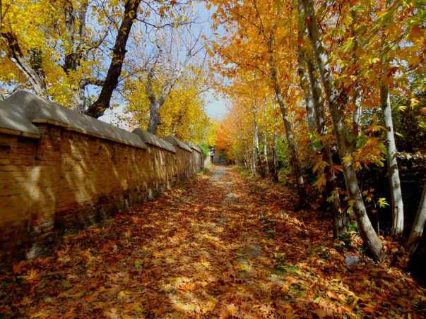
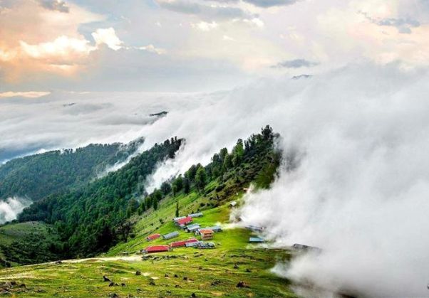
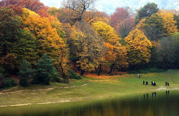
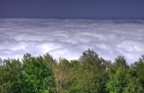
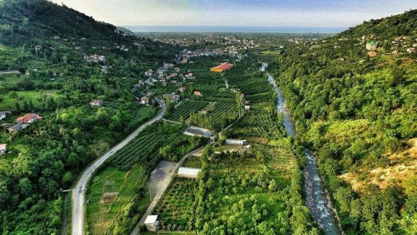
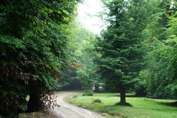
The Caspian and the inland, or southern, slopes of the Elburz differ markedly from each other in climatic and vegetational aspects. The Caspian slope has a distinctly humid climate, thanks to northerly air movements, enriched with moisture from the sea, which collide with the steep faces of the mountains to cause precipitation. The precipitation amounts to more than 40 inches (1,000 mm) annually in the lowlands of the Gīlān region and is even more plentiful at higher elevations. Although it decreases toward the east, it still suffices to nourish a humid forest for the whole length of the chain on the Caspian side, where the soils are mostly of the brown-forest type. The natural vegetation of that slope grows in distinct zones: the luxuriant Hyrcanian forest on the lowest levels; a beech forest in the middle zone; and a magnificent oak forest from the elevation of 5,500 feet (1,700 metres) up to the levels where gaps in the divide allow the moist air to overflow into the inland basins. In some sheltered valleys there are extensive stands of wild cypress. Sheltered valleys adjacent to the Safīd River constitute the only olive-growing areas of note in Iran.

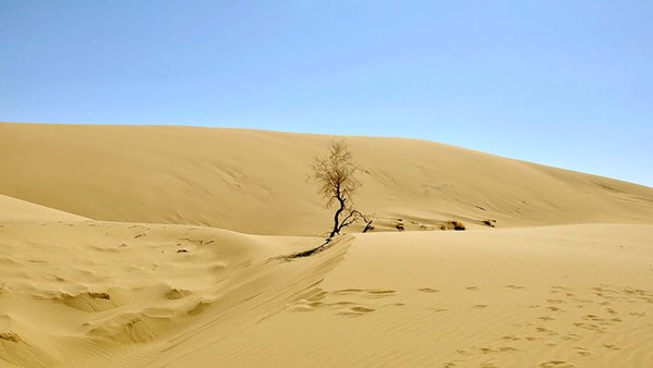
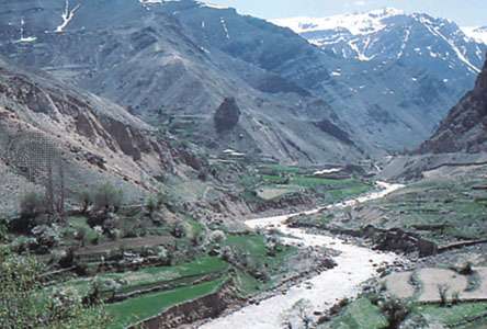
The southern slope of the Elburz, by direct contrast, shares the arid character of the Iranian plateau. Annual precipitation varies between 11 and 20 inches (280 and 500 mm) and is very irregular. The soils are mostly of the type associated with steppe (treeless, grassy, or shrubby) vegetation. The slope has become even more steppelike ever since the almost complete destruction of its original dry forest of junipers.

The Hyrcanian tigers for which the Caspian forests were famous are now extinct, but other wild cats, such as the leopard and the lynx, are still numerous in the Elburz. The bear, the wild boar, red and roe deer, the mouflon (wild mountain sheep), and the ibex are also present. Eagles and pheasants are notable among birds.

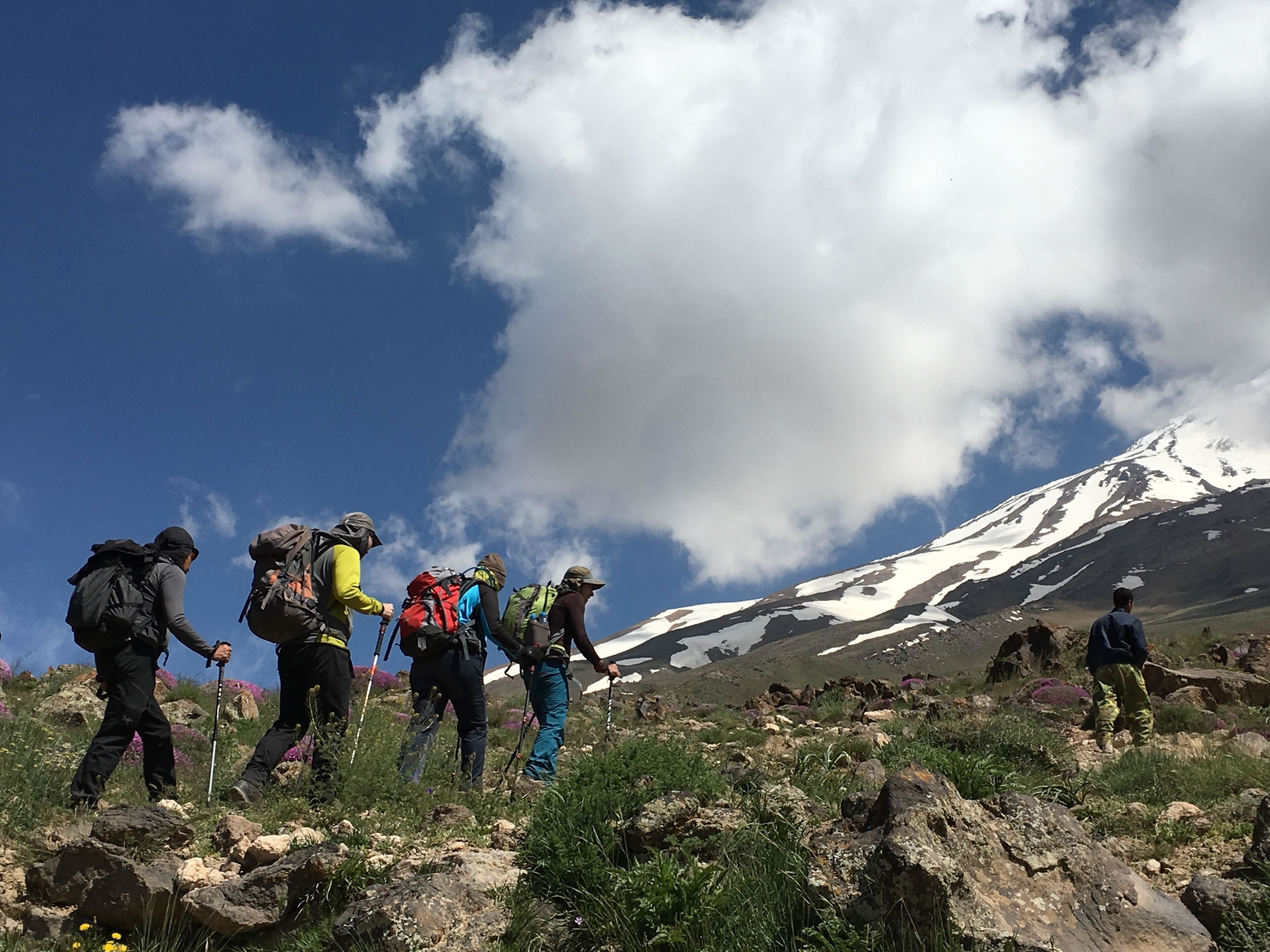
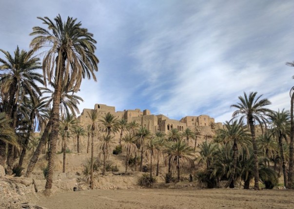
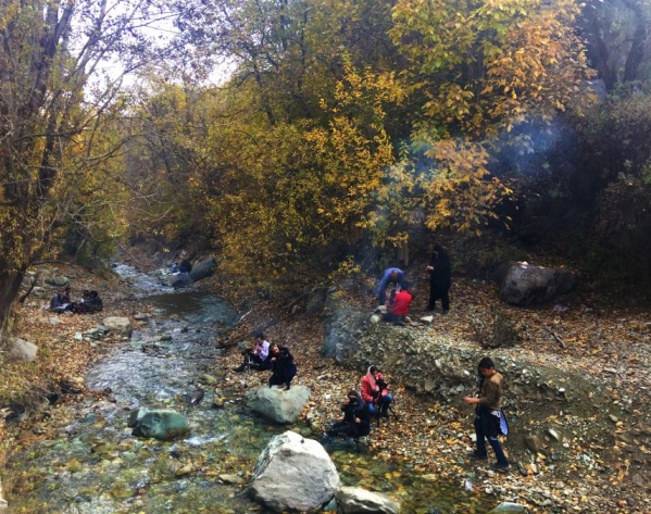
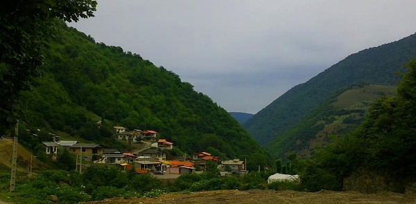
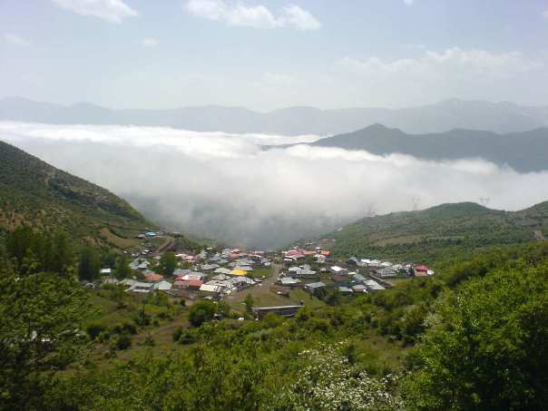
Although large areas of the Elburz Mountains are almost uninhabited—some being occupied only by nomads and others having been depleted by Turkmen raids in the 19th century—there are still several well-settled districts, including Deylamān, Alāmut, Tālaqān, and Lārījān (at the foot of Mount Damāvand). The landscape of the Caspian slopes is characterized by forest clearings with shingle-roofed loghouse villages and by lush fields and pastures. The landscape of the inland slopes is of the oasis type. Extensive grain cultivation occurs on both slopes, and cattle raising occurs on the Caspian side. Alpine pastures, seasonally dotted with flocks of sheep, cover an extensive zone yet higher. The land-distribution pattern prevailing in the Elburz includes a high proportion of peasant ownership. The holdings often are much-fragmented.

Many of the traditional ways of livelihood of the mountaineers, including charcoal burning (now prohibited because of devastation of the forests), the transportation of goods (especially of rice and of charcoal for Tehrān) by pack animals, and the working of hundreds of small coal mines, have been displaced by the 20th-century modernization of Iran.

Apart from the main line of the trans-Iranian railroad, which links Tehrān with Bandar-e Torkeman via the Gadūk Pass, there are several asphalted roads across parts of the Elburz. From west to east, those run between Ardebīl and Āstārā, between Qazvīn and Rasht, between Tehrān and Chālūs, between Tehrān and Āmol (via Damāvand); between Tehrān and Bābol (via Fīrūzkūh), and between Shāhrūd and Gorgān (via Kotal-e Zardāneh Pass).

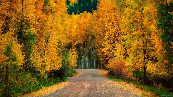
The wild (natural or original) forests of the Elburz Mountains cover more than 8,000,000 acres (3,000,000 hectares), of which some 3,000,000 acres can be exploited commercially for timber and other wood. There are also a few modern coal mines, as well as some deposits of iron and other ores. But most important is the water of the rivers, which is used for irrigation, for generating hydroelectric energy, and for supplying the fast-growing Tehrān. Spectacular dams have been built. Those include the Safīd Rūd Dam, used for the irrigation of the Safīd Rūd delta; the Karaj Dam and the Jājrūd Dam, used mainly for supplying water to Tehrān and partly for irrigation; and a series of dams on other rivers of the Māzandarān ostān (province) also used for irrigation.

Ratepost


The other side to ancient Iran, with an abundance of culture & history, is its breathtaking four season nature which has no shortage of scenic views. Among the very best sits the holistic Mount Damavand wrapped in snow on its cap all year round, a popular destination for trekking lovers.

The volcanic Damavand, inactive for more than 38500 years, rises above the clouds at 5671 meters (18606 feet) and has crater with a 400-meter diameter. The region harbors a great variety of wildlife, vegetation and natural features such as huge glaciers & sulfuric hill at the peak besides its hot springs situated in lower level skirts.

Cited in Ferdowsi’s Shahnameh, Damavand has deep roots in Persians beliefs and faith. There are 16 routes towards the peak with various degree of difficulty, making the Mount one of the most accessible peaks globally in class of 5000+ meters.

The southern face climb goes all the way up from Polur Village and your journey begins here. Your trekking adventure to Damavand summit starts from Polur. Read on to find out about the most exciting climb in Middle East happening to be the highest!

Itinerary of Damavand Trekking Tour is found here.

Damavand

Damavand


Polur


A heaven in the heart of hot summer days, the mountainous village of Polur (Pūlūr) becomes an ultimate destination for trekking camps base, most of which heading towards the splendid Mount Damavand – the highest peak in Mid-East.

Located at a height of 2300 meters, Polur sees dozens of wildflowers growing after snowmelt runoff occurs in mid-April followed by flourishing of yellow & Anemone flowers in late May & June.

This serene area, booming with tourists, backpackers and climbers specially in hot seasons, is believed to be home to some ancient hoards, artifacts and other treasure troves which besides the perfect weather has drawn attention to itself. Although some of these are based on legends, there’s been Glasswares & Ceramics dating back to Parthian, Sassanids and early Islam era of Iran found here.

Other belief of the villagers is that, long back in time there once lived maidens of a legendary King up here in a citadel worshiping Water.

This castle resembles the one in Firouzabad Shiraz, namely Qaleh Dokhtar (The Maiden Castle) – a castle made by Ardashir I 209 AD.


The highest waterfall of Mazandaran Province, Shahandasht Waterfall at a height of 180 meters is one of many tourist attractions of the area which is near Polur village, an approximate 40-minute drive away.

A rock climbing site in Polur Complex welcomes climbers in different types such as Bouldering, Top Rope & Competition in a 900 square meter area.

Damavand

Damavand

Rineh Hot Spring


On south face climbs you’ll come across one amazing natural gem, the Rineh Thermal Springs. Located 21km away from Mount Damavand this natural attraction has several bathtubs and pools.

Different options of residence are available here and people mainly come here for its therapeutic properties from Metropolis of Tehran and other nearby towns each and every day.


The pleasant weather combined health benefits of thermal waters has made Rineh a popular spot not only for mountaineering adventurers but also for others looking for some quality leisure time.


Goosfand Sara

Goosfand Sara

Goosfand Sara (Sheepfold) or Modque Base camp


Goosfandsara is a mountain camping site located at 3050m altitude and is one main point as a stop in trekking to Damavand Summit. In this area there is a small mountain shelter or refuge, a mosque called Saheb Zaman (or Saheb al Zaman) and a sheepfold!

The climbing season sees to itself a lot of SUVs transferring climbers and their equipment to this campsite. Mules and porters are other means of transport available here on your way to the last campsite called Bargah Sevom.


Damavand

Damavand


Third Camp – Bargah Sevom

Coming up to the next and the last camp before reaching the top, is located Bargah Sevom at a level of 4150 meter. Standing up there you already are getting breathtaking views under your feet.


There is an old shelter, considered the oldest camp of Mount Damavand, and a newer hut built in 2009.

The trek towards the summit would take roughly 5-7 hours depending on physical conditions.

Plan your trip to Damavand as the best time is just now. This trek to the very top of Damavand has been labeled as a MUST and will be a unique experience you’ll never forget.

By Omid Mirzaie


Ratepost

8 reasons for Rafting in Iran
Rafting is one of the new sports in Iran that has found many enthusiasts in recent years and the regular boat ride program is provided by the tourist agencies.
Although Iran is a country that is located in a desert and dry area,but the special geographic location and the high mountain range of Iran have led to the creation of rivers in various parts of Iran.
If you are looking for adventures during your trip to Iran, Rafting in Iran is one of the best options available. In addition to all tourist activities, Rafting in Iran gives you the opportunity to have a real thrill. It is one of the popular water sports in Iran.The months of April, May, and June are considered the best times to take part in Rafting in Iran. There are many rivers that are ideal for rafting in Iran.

8 reasons for Rafting in Iran

There are several reasons why the program of Rafting in Iran turns into one of the attractions of traveling to Iran

Iran is cheap
According to the latest World Economic Organization, Iran ranked first in the world’s cheapest among 144 countries.
According to this report, Iran ranked 66.6, has the most suitable competitive position with other countries.So Iran is one of the cheapest destinations for tourists.

Is it  safe to visit  Iran?

All headlines on news and media are very different from what travelers face and experience in Iran. The US government and most Western countries have a long travel warning for Iran. Although I do not advise you to ignore this warning, I advise you to balance it with direct accounts of Americans and many other travelers who have recently visited the country. The country is beautiful, the story is rich and people are eager to demonstrate their almost sacred commitment to hospitality.
The best way to get the answer is to ask travelers who have visited Iran, we encourage you to visit and join our face book page, LinkedIn, twitter.

8 reasons for Rafting in Iran

Excitement and history Simultaneous  with each other
Some rivers for rafting are located in the provinces and historic cities of Iran, with many historical and ancient features such as Zayanderoud river in Isfahan province or Cesar river in Kurdistan province.
In these areas, you will not only enjoy water sports but also visit the historical monuments of these cities like historical mosques,Palaces, Castles, Caravansaries and other sights with hundreds of years of history.

Pristine landscapes along the riverside
There are several Rafting rivers in Iran, Parts of these rivers flow through woody and mountainous areas which have created unique features for tourists and athletes.
Sections of the northern rivers flow through the 4,000,000-year-old Hirkani forests, also, the western rivers of Iran pass through the Alborz Mountains, that beautiful mountainous scenery is very attractive.Also, the rivers of the Central Plateau of Iran in the province of Chahar Mahal and Bakhtiari not only provide you beautiful nature, but the ancient history is also attached to this part of Iran.

8 reasons for Rafting in Iran

Different rivers with various classification

Although Iran is located in a desert region, the presence of different mountains in the north and west of Iran has created a different face of them.
In these areas, roaring permanent rivers have provided special conditions for those who like these sports.There are different rivers for rafting and riding in Iran, but among them, 14 rivers have rafting conditions.They range from class 1 to 5.

Dispersion of the river in Iran
In some countries, certain areas are specified for rafting.But due to the special geographic features in Iran, various areas throughout Iran are suitable for rafting, White water rafting, Canoeing and etc.
So you can take a boat ride on the whole northern part of Iran or from the East to the West in the Alborz Mountains as well as from north to south-east of Iran along the Zagros Mountains.

8 reasons for Rafting in Iran

Modern facilities
Rowing programs are regularly carried out in the rivers of Iran, which increases the youth’s attention to this sport.Accordingly, the facilities and equipment needed for this are prepared, which is part of the necessity of these programs by the agencies.
These equipment are divided into two categories: Individual and group
Individual travels or Day Trip, are single or families traveler to these areas, and their facilities included: experienced guides, Water Cag, Life Jacket, Helmet, Neoprene Boots & Wetsuit.But the groups or Expedition, and the tourist who come for some days rafting have more as like as:Paddle Raft, Cargo Raft,Slalom,Sprint,Downriver, Kayak,Rescue/Safety Kayak,Race Kayak,Different Tent,First Aid,Canopy,Mobile kitchen,4WD Off-road cars,and more.

Professional Agencies
There are a large number of reputable agencies in the field of nature tours and White Water Rafting that offer the best types of tourist services and amenities required by travelers.

Ratepost

5 Special Offer for Autumn Cruise

The journey will not end only in the summer and its long days.The new season of travel to new areas begins with the coming of autumn.Pleasant weather,the smell of rain and colorful trees has prepared the best season for nature lovers.
Iran is a four-season country and due this particular feature you can visit some part of Iran in different seasons.
Traveling in Iran is not limited to spring or autumn.At any time, a part of this beautiful country prepares a special trip location for you.Autumn in Iran has different choices for you.The deserts provide the best trip for you in this season. Simultaneously,the northern forests of Iran are waiting for desert travelers with millions of colors.

We have 5 special offers for your autumn trip that you will have a memorable and colorful autumn tour in Iran.

Desert tourism
Autumn is the best season for lovers of the desert.In this season, the extreme heat of the desert and the cold of the nights are both tolerable.Since Iran is a desert country, then you will have different choices to travel to one of the beautiful deserts of Iran.
Maranjab desert near Tehran will have the best and the closest access to you.In addition, in this desert area you can visit all the features of the Iranian desert region in a small area as like as Sandy hills,SaltLake,Sandy roads,
The Silk Road,Desert Wildlife and other features of the desert areas.Also, the most important feature of this region is the implementation of the tour program as a one-day excursion program.
Our second suggestion for your desert program is the 2-day tour of Kashan and Abouzidabad Desert.Spend one day in Kashan and the other day in the desert of Abu Zaidabad.This area is just 30 minutes from Kashan.
In order to enjoy other desert areas in Iran, you need some medium-term plans that Iranian agencies will help you.

Nayband; Tabas
Another landmark of Iran in the fall is the village of Nayband.This desert village is known the Masooleh of Desert.Nayband is located 225 km south of Tabas and adjacent to the Lut desert.Nayband is one of the unique examples of staircase architecture that has been formed in the Lut Desert.In this type of architecture there is a dense set of houses in which the roofs of the houses are used as their upper yard.This architecture has created a solid correlation among the inhabitants of this region.
One of the most prominent and spectacular views of this area is seeing the sky at night with millions of stars.

Forestry; from Naharkhoran Forest to Londvil Forest
Autumn is the best season for walking in the Forest.Trees with thousands of colors and the smell of wet soil are autumn beauty that makes walking in the woods more enjoyable.3 Northern provinces of Iran with dense forests and tall trees will have unforgettable autumn landscapes.For the Trekking Trees in the Autumn make travel to one of these beautiful areas:
Naharkhoran Forest,Gorgan Province.
Asalem to Khalkhal Road,Gilan Province.
Alimestan Forest,Amol,Mazandarn Forest.
LondvilForest,Astara,Gilan Province.
Chamestan Road,Mazandaran Province.

Meybod,Yazd
This small town is located on the edge of the Yazd desert with 45 km distance from Yazd.You can experience four seasons of the year at this time.Spring mornings, summer heat noon, autumn sunset, winter nights and nights, are the autumn gifts for this city.Simultaneously, you can see the beauty of the desert and the old monuments of this city.
Some of these sights are:
Old Carevanseray,PostOffice,StoreWater,OldMosque,Pigeon Tower and Pottery workshops.

Tehran, Ahar Village
Tehran and its surroundings are also beautiful in autumn.You can enjoy the beauty of this great city by staying in Tehran
The villages around Tehran with beautiful forest areas will have nice scenery from autumn.
You can also enjoy these beauties by walking in the parks of Tehran or in the streets.The streets that are covered with long tree as Vali-e-Asr street.

Ratepost

The most beautiful trails of forestry from north to south
The Green Charm of Iran’s Forests!

Just take a few days out of our daily routine and let’s go to the dreamy regions of Iran.Cool air, green landscape and tranquil silence, and the clear waters of the springs, along with the whisper of the birds, are ahead of you.The beauties of the forest are not limited to the northern fringes of the country.Although traveling to the north and logging in one of the beautiful forests of this region will never be repetitive and tedious.But the journey to the Zagros forests and the ever-spring Mangrove forests on the south coast will also be an enjoyable and memorable experience.
Most of Iran’s forests are located in the northern regions of the country and south of the Caspian Sea.
These temperate climatic zones are drawn from the east of Ardebil province to North Khorasan province, and along with them, there are three provinces of Gilan, Mazandaran, and Golestan.

The most beautiful trails of forestry from north to south Header

The most beautiful trails of forestry from north to south Header

A few essential things:
“Jungle Trekking” is one of the most entertaining and exciting branches of “nature”, whose potential risks aren’t less than climbing.But with caution and a little familiarity with the route, there can be no possible risks.
The most important principle in “forestry” and sightseeing in the depths of the woods is to have a local guide.
But some other principles are essential:
1- Try to have a few bottles of water.
2- Wear cotton clothes, and to walk, use Walking boots, not flat.
3- It can always rain.So have a cover for your backpack.
4- If you go away from the countryside, be careful not to get close to the house, because it may be damaged by domestic dogs.
5- Take equipment like a rope, a sharp knife, a compass, and a map.
6- If you unconsciously separated from the group, inform them with making the loud noise.
7- Remember, this is you who have entered the nature and environment of the animal life, vazSo respect the privacy of the homeowners.Animals do not basically attack humans until they are noticed.So always keep your distance with every living thing.Remember, the quietest animals in the forest can also be dangerous to humans.

The most beautiful trails of forestry from north to south Vaz forest

The most beautiful trails of forestry from north to south Vaz forest

The songs of the “Waz” forest in a dream way

The forests of this area are related to millions of years ago and also the third period of geology.The paths of the “Vaz” forest pass through the old trees of this region.The highlands of the foresVaz” are part of the ancient Hyrcanian forest.The unique beauty of this area is for those who are going to visit the area on foot.You can see the beauty of this area in an 80 km way.

The most beautiful trails of forestry from north to south Gisom Beach

The most beautiful trails of forestry from north to south Gisom Beach

Camping in the beautiful Gilan Forest Tunnel

We take you to one of the Plain area and semi-mountainous regions of Gilan.This area has many beauties that attract every visitor.There is less tourist who comes to Gilan Province and does not go to Gisum forest.Gisum is one of the most beautiful and spectacular areas of the city of Talesh, located 18 km from Talesh Route in Rasht.The characteristic of the Gisom forest, which has made it attractive to tourists, is the existence of thick and tall forest trees that have risen to the sky on either side of the coastal road of Gisom.
These trees have created a beautiful and spectacular tunnel road with their green walls.

The most beautiful trails of forestry from north to south Alimestan

The most beautiful trails of forestry from north to south Alimestan

Jack and the Beanstalk, Alimestan forests!

When you walk on the roads of this forest, you enter the green heaven among the forests.When we run the roads of this forest path, Jack and the Beanstalk dream looks more believable!The beautiful forests of Alimistan are located 140 km from Tehran and you have to cross the road to Haraz.The people who roam the forest will be amazed by the beauty of this beautiful and pristine jungle.For climbers, the Alimistan Peak with a height of 2510 meters is the best choice.

The most beautiful trails of forestry from north to south Hara

The most beautiful trails of forestry from north to south Hara

The wonders of the ever-spring forest “Hara”

Just have a tidal journey to see one of the strangest planets in Qeshm Island and enjoy its beauty.Hara forest on the southern coast of Iran is the center of various types of aquatic animals, birds, and amphibians.Hares Forest, Qeshm Island, is the world’s largest hara forests, and UNESCO has recorded this forest on the world’s environmental inventory.Hara forests are located on the southern coast of Iran with an area of 9200 hectares in different parts of southern Iran.Most parts of the forests are located in the central part of the Persian Gulf.One of the most attractive parts of this forest is the fishing experience, go  toyougo to the dense forests of Hara in the evening and, while watching the dreamy sunset of the Persian Gulf, enjoy it.

The most beautiful trails of forestry from north to south Gorgan Forest

The most beautiful trails of forestry from north to south Gorgan Forest

Life Song in Golestan Fossil Forest

National Park of Golestan Iran is one of the fossil forests.Golestan forests are very wide and each section has a special type of climate.it is connected to the arid and semi-arid regions of the east of the country and northern Khorasan and Semnan provinces, and on the other hand, it is linked to the Caspian forests or Hyrcanian forests.A collection of broad-leaved trees that have covered all the north of Iran.In this forest, you can have wild and domestic animals like the bear, Boar, wolf,
Jackal, deer, And other kinds of animals.

The most beautiful trails of forestry from north to south Shahrood

The most beautiful trails of forestry from north to south Shahrood

Walk in the clouds, between the earth and the sky!

Let this life be upside down!No reason, walk on the clouds, sleep, experience another season of life.
The city of Shahrud is located i the desert and has a warm climate, but the “Cloud” forest is 50 kilometers far from it, it is cold.And always foggy.Cloud Forest, behind Bastam, facing Aliabad Katoul and Gorgan plain is the final destination for a memorable jungle.

The most beautiful trails of forestry from north to south Dalkhani Forest

The most beautiful trails of forestry from north to south Dalkhani Forest

Crossing the “Paradise Hall” in the Dalkhani forests!

Everything can be found in this area Mountain, Grass, Jungle, south-eastSea and whatever you expect to see in a forest area.The beautiful Dalkhani forests which is known as “Paradise Hall”, with massive trees and pleasant weather, can provide one of the finest naturalist experiences.
Dalkhani is a village in the central part of Ramssoutheast of Ramsar.Dalkani is a semi-mountainous forest with a height of about 800 meters and is a good option for climbers.

The miracle of nature in the heart of Iran’s Lute Desert

In the central desert of Iran.In the dry desert of Reagan.
The largest reserve of forests by the name Kahoor and one of the wonders of nature in Iran is located in this area.
While Kavir Lut(desert) is in the eastern part of Kerman,
there are some natural species in the heart of this desert, it remains as an incredible miracle that has endangered the lives of many animals exposed to desert extinction.
This unique Iranian jungle saves 120 villages from the flood of sand.The spectacular jungle with 12 meters high and a safe place for animals and wildlife.

The most beautiful trails of forestry from north to south Tonekabon

The most beautiful trails of forestry from north to south Tonekabon

A Resorts In the heart of the forest over the cloud!

Nice sound, calm and quiet, full of rain, fog, waterfall and trees, place for being at a forest hut.The Aghoozhal forests, due to their location in the protected natural resources and environment area, have no habitat and are intact up to a distance of 30 kilometers.The forests are located in the Tonekabon area of Mazandaran province.

The most beautiful trails of forestry from north to south Fandogh Loo 1

The most beautiful trails of forestry from north to south Fandogh

Together with birds, Beside the hazel trees!

Fandoglu Forest is located in Ardebil province, 10 km from Namin city.Fandoglu area due to unique forest attractions, Rangelands and Heyran Road with a variety of natural charm, has an excellent feature of development in the ecotourism industry.The Fandoglu forest area is part of the forests of the eastern province of Ardebil, which is a continuum of the subtropical forests of Gilan province.

Ratepost


Filband: A Missing village in the cloud
This village is located in the western part of Bandpi, Babol, Mazandaran province, at an altitude of about 2300 meters above sea level.
The filband that is located on the eastern side of Mazandaran is known as the roof of Mazandaran province, as Like as a Watch tower, there is vast area under your eyes.
The winter begins very soon and ends late.


Ratepost