Empty skiing tracks in Iran
Iran enjoys largest untouched ski resort in world
The ski areas of Iran reach altitudes that eclipse even the highest tourist resorts of the Alps.

The Daily Daily Broadsheet ‘The Daily Telegraph’ in a recent report says Iran is the largest untapped ski resort in the world.

For most skiers and snowboarders, the idea of an off-piste paradise usually conjures up thoughts of the majestic peaks of Alaska, Verbier’s famous freeride field or Japan’s legendary dusty fields. Many, in a lasting way, would not consider looking at the mountains of Iran.

But hoping to lift the curtain on Iran’s off-piste terrain is Snoworks, a provider of ski courses based in the UK around the world. The company has announced a new trip to Iran’s top ski resorts for British skiers next March, along with tour operator Mountain Heaven.

Mountain Heaven’s Managing Director Nick Williams visited the country in March 2016 and was impressed by the terrain, the food, the friendly people and the atmospheric mountain cafes to launch their holidays. The Snoworks trip combines four of Iran’s main ski resorts: Dizin, Shemshak, Darbandsar and Tochal.

All resorts have unconnected off-piste areas accessed by a lift, but most skiers and snowboarders have probably never heard of them. Mountain Heaven also offers holidays in Dizin, Shemshak, and Darbandsar which, although not recommended for beginners, are based more on the slopes.

The Alborz Mountains in northern Iran extend from the border with Azerbaijan and along the western and southern coasts of the Caspian Sea. These holidays visit tourist centers in the center of the mountain range, to the north of the Iranian capital of Tehran.

The ski areas of Iran reach altitudes that eclipse even the highest tourist resorts of the Alps.

The Daily Telegraph quoted Phil Smith, Director of Snoworks, who said: “Skiing in Iran offers a real adventure, combining incredible culture and unforgettable skiing experiences.

“We will fly to Tehran with a stopover in the city before heading uphill in the Alborz Cordillera north of Tehran. Skiing in Iran is little known outside the country, but there is an immense mountain range, largely untapped.”

Snoworks will make your trip from March 10 to March 18, 2018, at a cost of £ 2,545 per person, based on two people sharing a room.

The price includes transfers, accommodation and breakfast provided by Ski Adventure Iran in association with Mountain Heaven, dinners at ski resorts, visa approval service, Snoworks guide instructions and tickets for any tourist visit to Tehran.

Rafting in Iran

Rafting in Iran is a new sport.Although Iran is a desert country with low rivers, in the mountainous regions of Iran, there are several rivers that are very suitable for this sport.
Some of these areas are:

Armand river in the green city of Chaharmahal and Bakhtiari
White River in the north of the country and in the beautiful province of Guilan,River with many rocks, Caesar in Lorestan province,Karaj River in Alborz Province,Sirvan River in Kurdistan Province, and the best area for this sport is Zayandeh Rood River in Isfahan Province and Chaharmahal and Bakhtiari with numerous rivers and longer trails, and beautiful historical and natural landscapes that has given a very special effect to this area.

Rafting in Iran

Zayande Rood River
This river is one of the most important rivers in Isfahan and Chaharmahal & Bakhtiari province.The best time for this river is spring, especially in the months of March and April.The waves of the Zayanderroud River are at level 2 and 3.

Haraz River
This river is located in Mazandaran province in the north of Iran.Rafting will take about 3 hours and has waves of 2nd and 3rd level.Parts of this river have waves of grade 4.

Rafting in Iran

Sefid Rood River
The natural scenery of this river is very beautiful and pass throughout of the best green province of Iran “Guilan”.This river is the second longest river in Iran and has waves of grade 2 and 3 and is suitable for Rafting and Kayaking.

Rafting in Iran

Caesar River
This river is from the branches of the Dez River in Lorestan province, and it is suitable for both beginners and professionals due to its 2 to 4-degree waves.The length of the Caesar River is 515 km and its average slope is 0.4%.

Rafting in Iran

Armand River
Armand is one of the major rivers of Chaharmahal and Bakhtiari province and is considered as the main potential of this province because its catchment area includes more than 50% of the province.
The river has the capacity for running programs and races due to the topography of the route as well as the river water level.

Rafting in Iran

The land of Q Inversed Tulips

The province of Chaharmahal and Bakhtiari covers 16, 533 square kilometers

of land is a mountainous region in the southwest of Iran. The provincial capital is called Shahr – e – Kord, with the height of 2.150 meters, being the highest city in Iran. The province has vast forest covering almost 30,700 hectares of land, which include oaks, wild pistachio, nuts, and almond. The mount Zagros is an attractive range of mountains stretching from northwest to southwest of the province.

As a whole, 76 percent of the province is covered by mountains and hills. The most famous and highest mountain is Zard Kooh.

land of Q Inversed Tulips

 (yellow mountain) and the highest peak is ” koloonchi “.

Mount Zagros has beautiful icebergs and a particular road formation, making it a particular interest to the mountain climbers from around the world. The most famous natural attraction is called the chaghkhor pond. This beautiful pond is about 2,300 hectares and is situated near the town of Boldajee. The fine weather and the natural beauty of its beautiful native birds, make this province one of the most pleasurable attractions in the world.

land of Q Inversed Tulips

The mineral spring

The famous mineral spring of the province is called Dimeh, which is the main source of Zayandeh Rood [ river ], one of the important rivers of Isfahan, and is 10 km away from a town called Chalgerd, near a village called Dimeh. The water of this spring is among the best and purest mineral waters and has medical remedies (prevents the decay of the teeth and remedies the kidney stone)

land of Q Inversed Tulips

Special Tulip Garden

12km away from Chelgerd which is a place near the village of Bano Esteki in the suburbs of Koohrao city.

This amazing and wonderful covering of tulips to a vast area approximately 3/400 hectares.

Koohrang Tunnel

This tunnel was built in 1953 to transfer the water of Koohrang and other springs to the Zayandeh Rood. the nearest tourist city is Chelgerd the central city of knohrang. During all seasons even winter, this place makes an ideal place for the skiing enthusiasts

 Tange sayaad sanctuary – Sabzeh kooh sanctuary –  Flying forest park – Saraab cave are some other beautiful landscapes of this province.


Iran’s annual handicraft exports stand at $250m

Iran exports handicrafts valued at $250 million each year, said a top official in the handicrafts sector.

According to ifpnews.com, Deputy Head of Iranian Cultural Heritage, Handicrafts and Tourism Organization (ICHHTO) Bahman Namvar Motlaq further said, “Handicrafts exports have currently tripled and even within the country, there is a growing interest in handicrafts given the measures adopted.

“The handicrafts of every country are the first representation of that country’s culture for tourists, and, hence, are very important.”

He said roughly ten percent of the turnover in the handicrafts sector is associated with exhibitions, which not only serve as a forum for economic activity, but also provides an opportunity to make the public familiar with handicrafts.

He said the handicrafts sector can bring in money and create jobs.

“Official figures suggest the country’s handicrafts exports stand at $250 million annually. With just $1 million in the handicrafts sector, we can create ten times as many jobs as we can with one million petrodollars,” he said.

“Handicrafts have a very high added value, and this industry does not need contribution by foreign companies,” he noted.

He said Iran has the most diverse handicrafts in the world, adding, “We should use handicrafts in our homes to promote an Islamic-Iranian lifestyle. We should keep this culture and cultural diversity alive.”


Iranian private sector opens hospital for medical tourists
The largest private hospital in western Iran is expected to open by March 2018 to provide medical services to Iranian and foreign medical tourists.

The construction of the Milad hospital as the largest private hospital in western Iran is now in its final phase, according to a Farsi report by Khabar online news agency.

The Milad hospital, which is under construction in the town of Orumiyeh in the western province of Azerbaijan, should be equipped with the most advanced medical technology.

Nearly $ 260 million has been invested to date to complete the first phase of the hospital’s main building, which has been built on an area of 26,000 m². Including the hospital complex, it occupies a 45,000 m² plot in Orumiyeh.

It has various neighborhoods, including maternity, surgery, physiotherapy as well as laboratories, administrative sections and specialized clinics.

The CEO and board member of the hospital, Kamran Jamshidi, said the construction project is underway with private investments from the country’s medical company.

“The idea of the project began to appear in 2010, but it officially began a year later after the purchase of a large land in Orumiyeh”.

He went on to say that the construction process has the full support of the Ministry of Health, the office of the governor of Azerbaijan West and the municipality of Orumiyeh.

Jamshidi also noted that the construction process has grown in particular last year and added the first phase of the project, which includes 100 beds, is already completed and will be operational in the near future.

The construction of the hospital with a capacity of 300 patients will be completed at the end of the current calendar year of Iran (March 20, 2018), he added.

On the main objective of the Medical Association to build the hospital, Jamshidi said that since the Western Azerbaijan suffered from a massive lack of medical equipment, the association decided to take a measure at In this regard and to remove at least a major part of the shortage of medicine in the province.

“Given the proximity of some regional countries such as Iraq and Turkey, Western Azerbaijan Province can offer services to foreign tourists and Milad hospital can offer services to patients from other countries, “He noted.

Jamshidi stressed that the provision of luxurious services to attract tourists is one of the main factors motivating investors of the Milad hospital.

He stated that the main shareholders of the project are members of the Medical Association.

“About 200 people are involved in the project and we hope that all the other members of the Association will participate in the struggle and will collaborate with the project,” he added.

Elsewhere in his statements, Jamshidi stated that 90% Of the hospital’s construction operations were carried out by the local chiefs and added about $ 270 million has been invested so far to operationalize the first phase of the project.

The end of the entire project will cost about $ 540 million, he added.

Another member of the board of directors of the Milad hospital, Hassan Entezami, said that the hospital is the first intelligent hospital in Iran that is equipped with optical fibers. “He is also able to have an online connection with other smart hospitals around the world,” he added.

“The board of directors has decided to employ skilled doctors and send them to countries like Switzerland, Germany, and Sweden for specialized training,” he said.

He went on to say that the council decided to set up a number of apartment hotels near the buildings to accommodate patients and offer them more services.

“So far, the semi-autonomous region of Kurdistan has expressed interest in sending its patients to the Milad hospital for treatment,” he noted.

“The Milad hospital aims to provide medical services to foreigners in order to attract more tourists to the region,” he said.

The hospital also creates jobs for at least a thousand people, he concluded.


The Dasht-e Kavir, is one of two deserts dominating the region’s landscape, is a mix of sand and salt as blinding in its whiteness as it is deafening in its silence. Dasht-e Kavir, is also known as “Kavir-e Namak” and “Great Salt Desert”, is a large desert lying in the middle of the Iranian plateau, around 300 kilometers east-southeast of Tehran. Dasht-e-Kavir desert is approximately 800 kilometers long and 320 kilometers wide, and composed of mud and salt marshes. Millions of years ago, this region was occupied by a salt-rich ocean that covers a small piece of continent in what is now central Iran. As the time passes, the ocean gets dried up, it left behind a layer of salt as much as 6 to 7 kilometers thick.

Therefore, over the time, the layer of salt was buried under a thick layer of mud; however salt has a fairly low density lower than the layer of mud and rocks underneath which the salt layer lay. So it taking place pushing up through the overlying sediment and finally, over millions of years, the salt broke through and formed domes. The salt domes of Dasht-e Kavir are probably some of the best examples of this geological marvel. Thus, geologists have recognized about 50 large salt domes in this region. Some of the domes have been eroded away by wind and rain exposing its cross-section.

Dasht-e Kavir

However, the desert climate is arid and receives little rain and snow each year, but the surrounding mountains on all side, provide plenty of runoff to create vast seasonal lakes, marshlands and playas. Temperatures can reach 50 °C in summer, and the average temperature in January is 22 °C. Though it looks like a firm surface, the salt crust is only a few inches thick, below which lies soft grease-like mud the Iranians called “Charbeh” that is really difficult to get out of if one were to get stuck. Due to arduous travelling to Dasht-e Kavir, it is very dangerous. The soil is sterile and not appropriate for cultivation. In summer the hot temperatures cause extreme vaporization, which leaves the marshes and mud grounds with large crusts of salt. Heavy storms frequently occur and they can cause sand hills reaching up to 40 m in height. Some parts of Dasht- e Kavir have a more steppe-like appearance.

Dasht-e-Kavir desert is almost uninhabited and only partly explored. Wild sheep, camels, goats and Persian leopards also live in the mountainous areas. Hence, human settling is restricted to scattered oases, where wind-blocking housing constructions are raised to deal with the tough weather conditions. Some live in the hills and the surrounding mountains. Against the odds, oases exist within these desolate environs, home to villages that are sustained by the wells of sweet water that have been part of desert mythology for centuries. Vegetation in the Dasht-e Kavir is adapted to common plant species like shrubs and grasses can only be found in some valleys and on mountain tops. So, the most widespread plant is mugwort. The Persian ground jay is a bird species living in some parts of the desert plateaus, along with Houbara bustards, Persian gazelles, camel, goats, leopards, larks and sandgrouses.

Moreover night life brings on wild cats, wolves, foxes, and other carnivores, the Persian onager and Asiatic cheetah can be seen. Lizards and snakes live in different places in the central plateau. The extreme heat and storms in Dasht-e Kavir cause extensive erosion, which makes it almost impossible to cultivate any lands almost uninhabited and knows little exploitation. Camel and sheep breeding and agriculture are the sources of living to the few people living on its soil. For irrigation, Iranians developed a sophisticated system of water-wells known as qanats. These are still in use, and modern globally used water-revenue systems are based on their techniques.


Dasht-e Kavir, or the Great Salt Desert National Park, is a large desert lying in the middle of the Iranian plateau about 300 kilometers east-southeast of Tehran. A total surface area of about 77,600 km2 makes it the Earth’s 26th largest desert. This desert stretches from Alborz mountain range in the north-west to Dasht-e- Lut in the south-east and is partitioned between the Iranian provinces of Khorasan, Semnan, Tehran, Isfahan and Yazd. This amazing desert is about 800 kilometers long, and more than 320 kilometers wide, and composed of mud and salt marshes. Tens of millions of years ago, this region was occupied by a salt-rich ocean that surrounded a small piece of continent in what is now central Iran. As the ocean dried up, it left behind a layer of salt as much as 6 to 7 kilometers thick. Over time, the layer of salt was buried under a thick layer of mud. But salt has a fairly low density, lower than the layer of mud and rocks underneath. So it started pushing up through the overlying sediment and eventually, over millions of years, the salt got out and formed domes. The salt domes of Dasht-e-Kavir are probably some of the best examples of this geological phenomenon.

Dasht-e Kavir’s climate is arid and receives little rain and snow during the year. However, the surrounding mountains on all sides provide plenty of runoff to create vast seasonal lakes, marshlands and playas. Temperatures can reach 50 °C in summer, and the average temperature in January is 22 °C. Day and night temperatures during a year can differ up to 70 °C. Rain usually falls in winter.

The desert soil is covered with sand and pebbles. There are marshes, seasonal lakes and seasonal river beds. The hot temperatures cause extreme vaporization, which leaves the marshes and mud grounds with large crusts of salt. Heavy storms frequently occur and they can cause sand hills reaching up to 40 m in height. Some parts of Dasht-e-Kavir have a more steppe-like appearance.

Geologists have identified about 50 large salt domes in this region some of which have been eroded away by wind and rain exposing its cross-section.

Although it looks like a hard surface, the salt crust is only a few inches thick, below which lies soft grease-like mud that Iranians call “Charbeh”, which is extremely difficult to get out of if one gets stuck in. Due to this fact, travelling in Dasht-e-Kavir is extremely dangerous. The soil is sterile and not suitable for cultivation. The desert is almost uninhabited and only partly explored. Human settling is restricted to scattered oases, where wind-blocking housing constructions are raised to deal with the harsh weather conditions. Some live in the hills and the surrounding mountains. Wild sheep, camels, goats and Persian leopards also live in the mountainous areas.

Introduction of Kermanshah

As the capital of Kermanshah province, it’s situated in western Iran. Kermanshah is the principal city in this region, and also one of the tourist Attractions in Iran. With an altitude of about 1200 m above sea level, it has a moderate and mountainous climate. According to 2006 census, the population of this city was about 950400. The language mostly spoken in Kermanshah is Kurdish.

The average annual precipitation and relative humidity in this region is to the extent that mountain slopes and plains are mainly covered with woods and pastures, and in some areas dry farming is applied. The average annual temperature is about 14 C there.

Lying within the Zagros chain, and providing natural shelters and caves were the reasons which made Kermanshah a proper settlement for humans in Stone Age. Archaeological excavations prove that prehistoric people used to occupy this area. The discovered objects dates back to at least 200000 years ago.

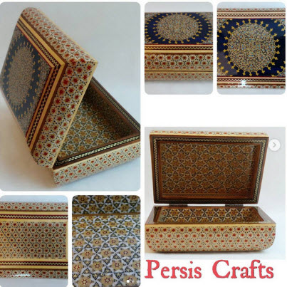
A major part of the city’s prosperity depends on agriculture. But there are also some other factors like food processing, constructional materials, and local handicrafts like kilim or carpet weaving, cotton-shoe making (Giveh), leather works, etc. Kermanshah is a center of Iranian and Kurdish traditional music. It’s been the homeland of prominent figures in literature, art, history, science, and politics.

Major industrial installations in this city include sugar refinery factories, oil refinery, petrochemical complex, cement factory, and a citric acid plant which is the only one throughout the Middle East.

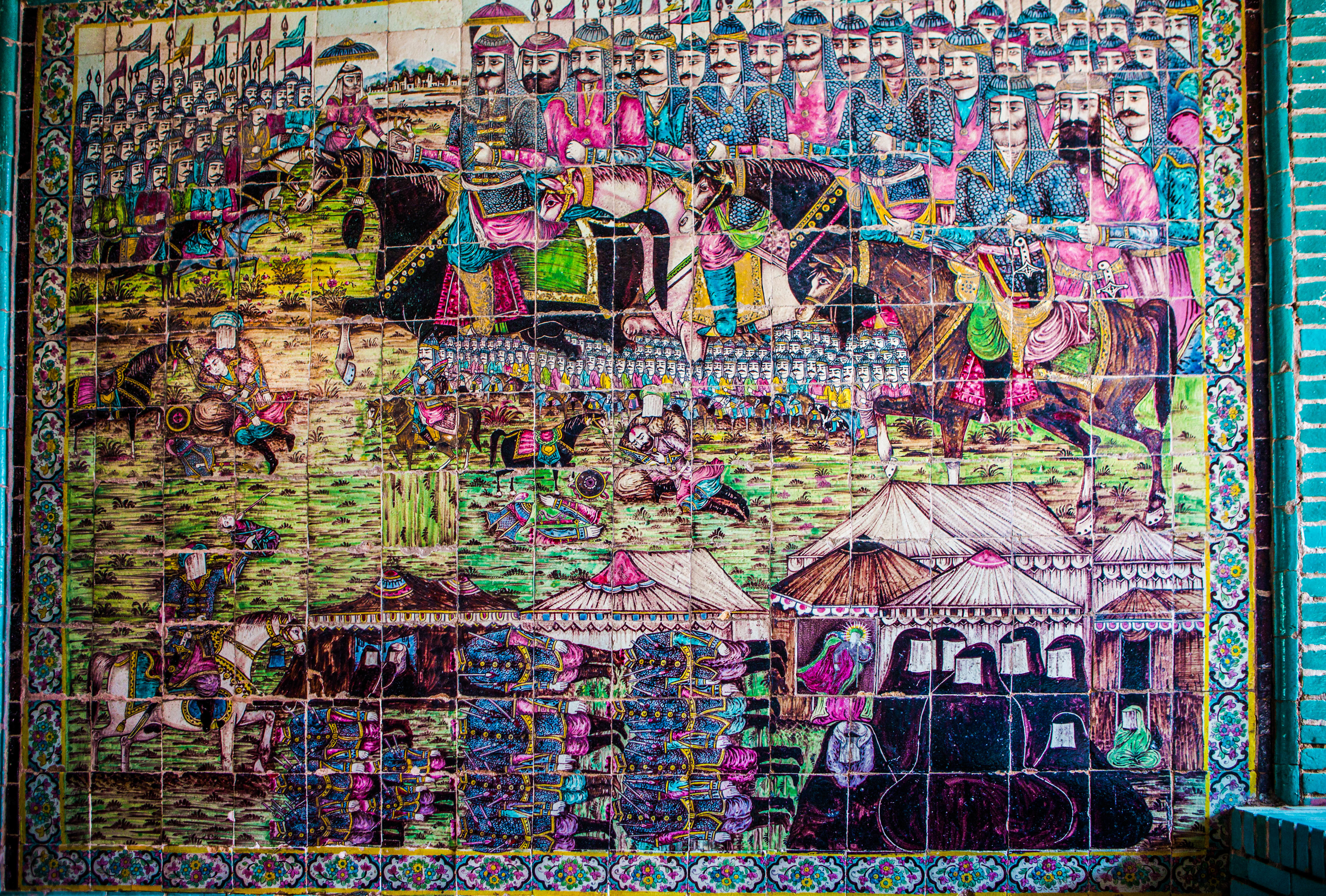
This city is also well-known because it’s related to a legendary Persian love story. The story narrates a tragic romance between Khosrow II (the last king of Sassanid Empire), Shirin (Khosrow’s lover), and Farhad (a stonemason who was in love with Shirin).

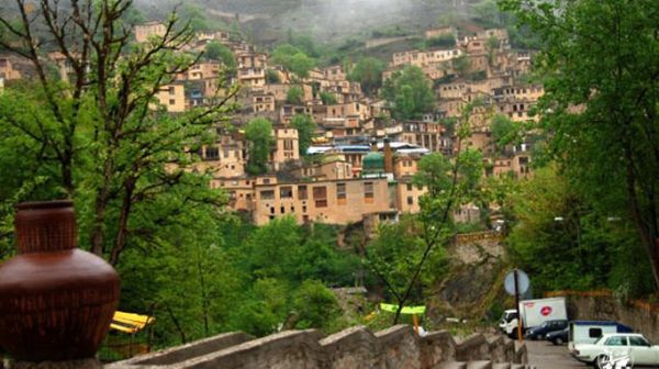
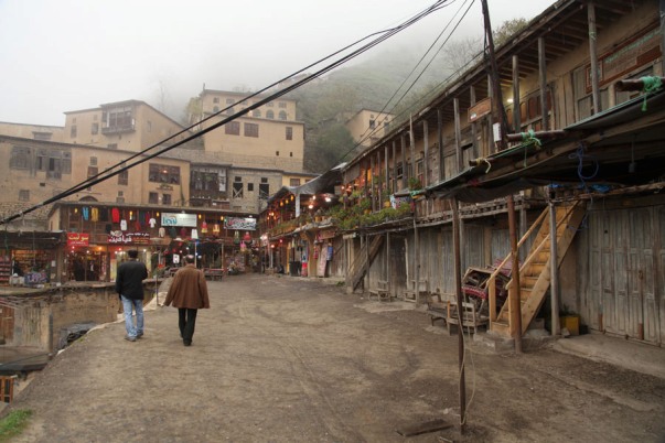
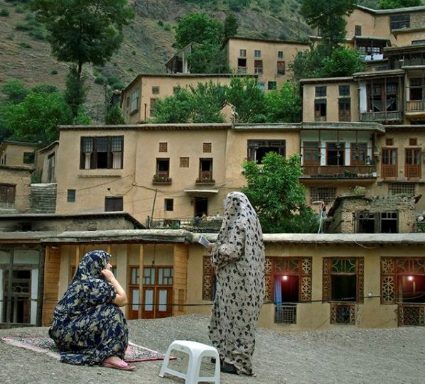
This city has a lot to offer as a tourist attraction.

Kermanshah

History of Kermanshah

Pre-Islam Era

Kermanshah has been always the link between Iranian plateau and the Mesopotamia throughout its history. In the fourth millennium BC, the region currently known as Kermanshah province, was one of the most important centers of trade and commerce with Mesopotamia. There were also many conflicts and wars between these two nations. Therefore, this region used to be the center of various Iranian and Mesopotamian civilizations and governments for centuries.

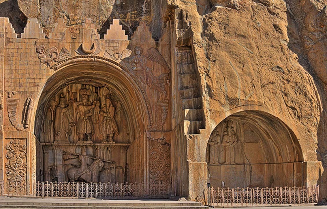
During Buyid period, some miner Kurdish dynasties rose in the areas around Kermanshah. It had a military and economic importance in Saljuq period. The reason was its location at the intersection of a great highway linking the city to major trade areas inside and outside of the Iranian Plateau. And, it was one of the major cities as well as one of the dynastic capitals in Sassanid period. This glorious city was also the summer resort for Sassanid kings.

Post-Islam Era

In 640 A.D., after the Arab invasion of Iran, Kermanshah was occupied and destroyed completely by Arabs. The population decreased, and its residents moved to another city. About a decade later, people rebuilt the city at the bank of Qarasu river.

During the reign of Abbasid caliphs, it was an important city because of its strategic location. In 1220 A.D., after Mongol invasion of Iran, Kermanshah was badly damaged again.

  • Safavid Period

In the early Safavid period, due to Iran’s conflicts with Ottoman, ruling Kermanshah was a complicated situation. At times, Ottomans could defeat Iranians and rule over the city. But some other times, they were defeated by Iranians and left its ruling to Iran. But from the reign of Shah Safi, the sixth king of Safavid dynasty, to the end of Safavid period, the city was enjoying a period of peace and prosperity.

  • Afsharid Period

Benefiting from artillery attributed to Nader Shah, the founder of Afsharid dynasty, Kermanshah gained a military significance. Such condition made the city a battlefield between Nader Shah and Ottomans.

Because of its artillery, Kermanshah was the focus of attention after the death of Nader Shah. There were many conflicts over the takeover of the city among those who sought power, and it was Karim Khan Zand, the founder of Zand dynasty, who won.

  • Zand Period

In 1753 A.D., Karim Khan invaded Kermanshah, destroyed and evacuated it completely so that, for nearly 10 years, there was nothing called Kermanshah. Then, in 1762 A.D., the city was revived in the southwest of the former location, and Allahqoli Khan (from Zanganeh family, a local Kurdish tribe) ruled there as the governor.
Kermanshah enjoyed a short period of peace due to having Allahqoli Khan as its most powerful governor. But after the death of Karim Khan, he claimed the throne, and this led the city toward civil conflicts once again. Throughout Zand period, Zanganeh family governed Kermanshah most of the time.

  • Qajar Period

In 19th century, Kermanshah experienced a progress in terms of commercial and strategic significance. The city was flourishing. It also had a political and social importance to the government.

The appointment of Mohammad Ali Mirza, the sixth king-to-be of Qajar dynasty, as the governor of Kermanshah was one of the best things happened to the city. He started urban planning and caused the city to develop greatly. For instance, he Constructed caravansaries and accommodations for merchants, and build a new fortress.

There were two major reasons which made Kermanshah a critical area for The Qajars. First, their relationship with Ottomans in Iraq. And second, making it secure for the pilgrims so that they could go to Iraq and visit the Shiite’s shrines there. Qajar kings managed to restore relative security in this region.

  • Contemporary Period

Kermanshah played an important role in Constitutional Revolution in Iran. It was a movement from 1905-1911 for establishing a constitutional regime in which the people of this city were actively involved.

In the late World War I, Kermanshah was seized by Ottoman Forces. Also, during World War II, Great Britain forces seized the city and it remained occupied until the end of the war.

Kermanshah played a major role in Islamic Revolution of Iran in 1979 as well. It was one of the resistance centers against Pahlavi regime. It was among the cities of Iran which underwent a lot of damage during the eight-year war of Iran and Iraq (1980-1988).

Takieh_Mo'aven_ol-Molk

Bistoun’s inscription at Bisotun – which dates to 522 BCE, lies some 1300 meters high in the mountains. The site is a UNESCO World Heritage site and has been attracting visitors for centuries. The Behistun inscription is in old Persian cuneiform. What the Rosetta Stone is to Egyptian hieroglyphs: the trilingual inscription (in Old Persian, Elamite and Akkadian) was crucial in the decipherment of the script. The relief above the inscription depicts Darius facing nine rebels who objected to his crowning. At the king’s feet lies Gaumata. The location of this important historical document is not coincidental: Gaumata, a usurper who is depicted as lying at Darius’ feet, was a Medean and in Achaemenid times Behistun lay on the Medea-Parsa highway. Behistun is also notable for three reliefs at the foot of the hill that date from the Parthian era. Among them is a Hellenistic-era depiction of the divinity Bahram as the Greek hero Hercules, who reclines with a goblet in his hand, a club at his feet and a lion-skin beneath him. Because it lies on the route of an ancient highway, this life-size rock sculpture may reflect Bahram’s status as patron divinity of travelers.

Taghe Bostam The rock reliefs at Taq-e Bostan lie four miles north-East of Kermanshah, where a spring gushes from a mountain cliff and empties into a large reflecting pool. One of the more impressive reliefs, inside the largest grotto (ivan), is the oversized depiction of Sassanid king khosrey the second (591-628 CE), who appears mounted on his favorite charger, Shabdiz. Both horse and rider are arrayed in full battle armor. There are two hunting scenes on complementary sides of the ivan: one depicts an imperial boar hunt and the other depicting the king stalking deer. Elephants flush out the boar from a marshy lake for the king who stands poised with bow and arrow in hand while he is serenaded by female musicians following in other boats. These royal hunting scenes are narrative murals in stone are count among the most vivid of all Iranian rock reliefs. The Taq-e Bostan reliefs are not limited to the Sassanid era. An upper relief depicts the 19th century Qajar king Fath-Ali shah holding court.

Ahwaz Visiting Places

Chogha Zanbil is an ancient Elamite complex in the south of Iran. It is one of the few existent Ziggurates outside of Mesopotamia. Choga Zambil means ‘basket mound.’ It was built about 1250 BC by the king Untash -Napirisha, mainly to honor the great god Inshshinak. Its original name was Dur Untash, which means ‘town of Untash’, but it is unlikely that many people, besides priests and servants, ever lived there. The complex is protected by three concentric walls which define the main areas of the ‘town’. The inner area is wholly taken up with a great ziggurat dedicated to the main god, which was built over an earlier square temple with storage rooms also built by Untash-Napirisha. The middle area holds eleven temples for lesser gods. It is believed that twenty-two temples were originally planned, but the king died before they could be finished, and his successors discontinued the building work. In the outer area are royal palaces, a funerary palace containing five subterranean royal tombs.

Although construction in the city abruptly ended after Untash-Napirisha’s death, the site was not abandoned, but continued to be occupied until it was destroyed by the Assyrian king Ashurbanipal in 640 BC. Some scholars speculate, based on the large number of temples and sanctuaries at Chogha Zanbil, that Untash-Napirisha attempted to create a new religious center (possibly intended to replace Susa) which would unite the gods of both highland and lowland Elam at one site.The ziggurat is considered to be the best preserved example in the world. In 1979, Chogha Zanbil became the first Iranian site to be inscribed on the UNESCO WORLD HERITAGE SITE.

Tomb of Daniel is the traditional burial place of the biblical prophet Daniel. Various locations have been named for the site, but the tomb in Susa, Iran, is the most widely accepted, it being first mentioned by Benjamin of Tudela, who visited Asia between 1160 and 1163.The Book of Daniel mentions that Daniel lived in Babylon and may have visited the place of Susa‌, Iran, but the place where he died is not specified; the tradition preserved among the Jews and Arabs is that he was buried in Susa. Today the Tomb of Daniel in Susa is a popular attraction among local Muslims and Iran’s Jewish community alike.

The earliest mention of Daniel’s Tomb published in Europe is given by Benjamin of Tudela who visited Asia between 1160 and 1163. In the fa’ade of one of its many synagogues he was shown the tomb assigned by tradition to Daniel. Benjamin declares however, that the tomb does not hold Daniel’s remains, which were said to have been discovered at Susa about 640 CE. The remains were supposed to bring good fortune: and bitter quarrels arose because of them between the inhabitants of the two banks of the choaspes River. All those living on the side on which Daniel’s grave was situated were rich and happy, while those on the opposite side were poor and in want; the latter, therefore, wished the bier of Daniel transferred to their side of the river. They finally agreed that the bier should rest alternately one year on each side.

This agreement was carried out for many years, until the Persian shah Sanjar, on visiting the city, stopped the practise, holding that the continual removal of the bier was disrespectful to the prophet. He ordered the bier to be fastened with chains to the bridge, directly in the middle of the structure; and he erected a chapel on the spot for both Jews and non-Jews. The king also forbade fishing in the river within a mile of Daniel’s bier.[2] According to Benjamin, the place is a dangerous one for navigation, since godless persons perish immediately on passing it; and the water under the bier is distinguished by the presence of goldfish.

Shushtar is an ancient fortress city in the khuzestan province in southwestern Iran. It is approximately 92 km away from Ahwaz. In the Elamite times Shushtar was known as Adamdun. In the Achaemenian times its name was Å urkutir. The modern name, Shushtar, is connected with the name of another ancient city, Susa, and means “greater (or better) than Shush.” During the Sassanian era, it was an island city on the Karun river and selected to become the summer capital. The river was channelled to form a moat around the city, while bridges and main gates into Shushtar were built to the east, west, and south. Several rivers nearby are conducive to the extension of agriculture; the cultivation of sugar cane, the main crop, dates back to 226.

A system of subterranean channels called Ghanat, which connected the river to the private reservoirs of houses and buildings, supplied water for domestic use and irrigation, as well as to store and supply water during times of war when the main gates were closed. Traces of these ghanats can still be found in the crypts of some houses. The ancient fortress walls were destroyed at the end of the Safavid era.The Band -e -Kaisar was a Roman arch bridge, and the first in the country to combine it with a dam. When the Sassanian Shah Shapur the first defeated the Roman emperor Valerian, he is said to have ordered the captive Roman soldiers to build a large bridge and dam stretching over 500 metres. Lying deep in Persian territory, the structure which exhibits typical Roman building techniques became the most eastern Roman bridge and Roman dam.

Its dual-purpose design exerted a profound influence on Iranian civil engineering and was instrumental in developing Sassanid water management techniques. The approximately 500 m long overflow dam over the Karun, Iran’s most effluent river, was the core structure of the Shushtar Histoical Hydraulic Systems, a large irrigation complex from which Shushtar derived its agricultural productivity, and which has been designated World Heritage Site by the UNESCO in 2009.

Masuleh one of the most beautiful Stair villages

situated in a mountainous area covered with lush vegetation and luxuriant forests, Masuleh is a village enjoying the splendid natural beauty. Being a village of great antiquity, it is like a living architectural and anthropological museum, attracting a great number of tourists each year.

Masuleh is 36 kms south -west of Fuman, in the province of Gilan. It is bounded on the north by the village of Alyan, on the east by Shaft, on the south by Poshtkuh-e Khamesh, and on the west by Zanjan province. It is surrounded by the Talesh mountains, some of which , located in the west, are more than 3000 meters

high. Although Masuleh is near the Caspian Sea i is 1050 meters   above sea level. This creates a pleasant climate. Lying between the sea and the high Alborz Mountains, wich trap humidity from the air, it enjoys a pleasant climate with high annual precipitation and lush vegetation. The fluctuation of temperature varies from a high of 20 ° in to a low of -2° in winter. The annual average precipitation is 713 millimeters , wich occurs mainly in autumn and winter.

The most important mountains, affording spectacular landscapes, are as follows: Kuh -e Rash, Kuh -e Makuf , Kuh-e Dasht-e Gileh Sar and Kuh-e Gur. Many rivers originate in យ៉ា , the largest of which is the Masuleh Rud. This river wich is formed by the merging of the Zangol and Gilvan rivers, runs as a mountain stream but flows into the plain and then to the swamp of Siyah Kashim. There are some other rivers, like Andareh and Nilikhali , merging into the Masuleh Rud .

 In this area are found broad-leafed deciduous trees – maple , hornbeam, beech, walnut, taxus and fagus. Grass and vetch grow on the highlands.

Masuleh dates back to great antiquity and was on the road connecting Azerbaijan to Gilan .

The ancient village of Masuleh was located 4 kms north-west of the present one Masalar and Khortab Khani are old names of the village. In winter, it is thinly populated, since most people leave the village. The people living in Masuleh are the Talesh ethnice group , speaking the Taleshi language.

Because of the topographical features, agriculture is not an active industry and most people are engaged in animal husbandry and producing handicrafts. The articles such as gelims (rugs made of goats’ hair), jajims (fine carpets made of wool or cotton), socks. traditional dress, knives, spades, axes, scissors, and scythes are produced in Masuleh . Making a certain type of shoes called chamush is another occupation. The leather used for making chamushes are produced in the tanneries of the village itself. The shops selling traditional goods are scattered throughout Masuleh .

Some people earn their livings by selling goods to the shepherds and buying dairy products from them. Apart from natural beauty, the unique architecture of the buildings is of high attraction for tourists. Most houses are two or three storeys high . Set on the slope of the mountain, the houses are arranged in a stair-step, so that the roofs of some houses are the yards of the others. The roofs also form the public passages.

Masuleh consists of four neighborhoods : Khanehbar , Masjedbar , Asad and Kash-e sar-e-Olya. It covers an area of 150000 square meters, and the difference between its highest and lowest point is 100 meters. The configuration of the village indicates that in the past the people showed much consideration for security . The houses and the decorations  the rooms represent the oriental character of life . The lattice windows and closets with exquisite decoration  are exponents of  the original Iranian craftsmanship. Most  houses  include a certain hall in which the family lives in winter  , a small veranda  extending from the  front of the house , and a guest – room . The houses of the rich include curtain small rooms in which precious articles are kept .

The materials used for building the houses are mud-bricks stones, timbers, clay and wild ferns (which abound there and are used in the roofs). Two kinds of soils, called yellow soil and dark soil. found on the river, are used for covering the outer walls and the roofs respectively.

The configuration of the village’s buildings makes the entering of the automobiles impossible . This has helped the original atmosphere to survive. The oldest buildings date back to 300 year ago, but their architecture is similar to that of the Sassanian period  . There are eighteen mosques and five shrines in Masuleh , the mostirnportant of which are Jame mosque and the mausoleum  , the Imam Zadeh Own obn-e Mohammad-e Hanafiyyeh located in the neighbourhood of Masjedbar the door of the mausoleum  , on  which there are highly impressive carved designs, is made of ebony.

The bazaar from which a spectacular landscape can be seen, is roofless and multi-storeyed . It is in the bazaar that many of handicrafts are produced and sold.

The library of Mausleh, dating back to thirty years ago, includes over 5000 volumes . The hotel of Masuleh is an impressive building .

The people living in Masuleh have the greatest respect for their own traditions. A religious ceremony called Touqbandi, being of high importance, is taken place in the seventh night of each lunar Islamic year, in front of Jame’ mosque. The wedding ceremonies are also of high importance . In the wedding night, the bride

followed by her relatives and friends who are singing songs praising Ali (peace be upon him ), the first Imam of the shi’it branch of Islam , walks to the groom’s home , entering it just at dawn. Spelendid natural beauty, a pleasant climate, luxuriant forests, lush vegetation , the unique architecture of the buildings and hospitable people make Masuleh a point of great attraction, regarded and registered as a national asset.