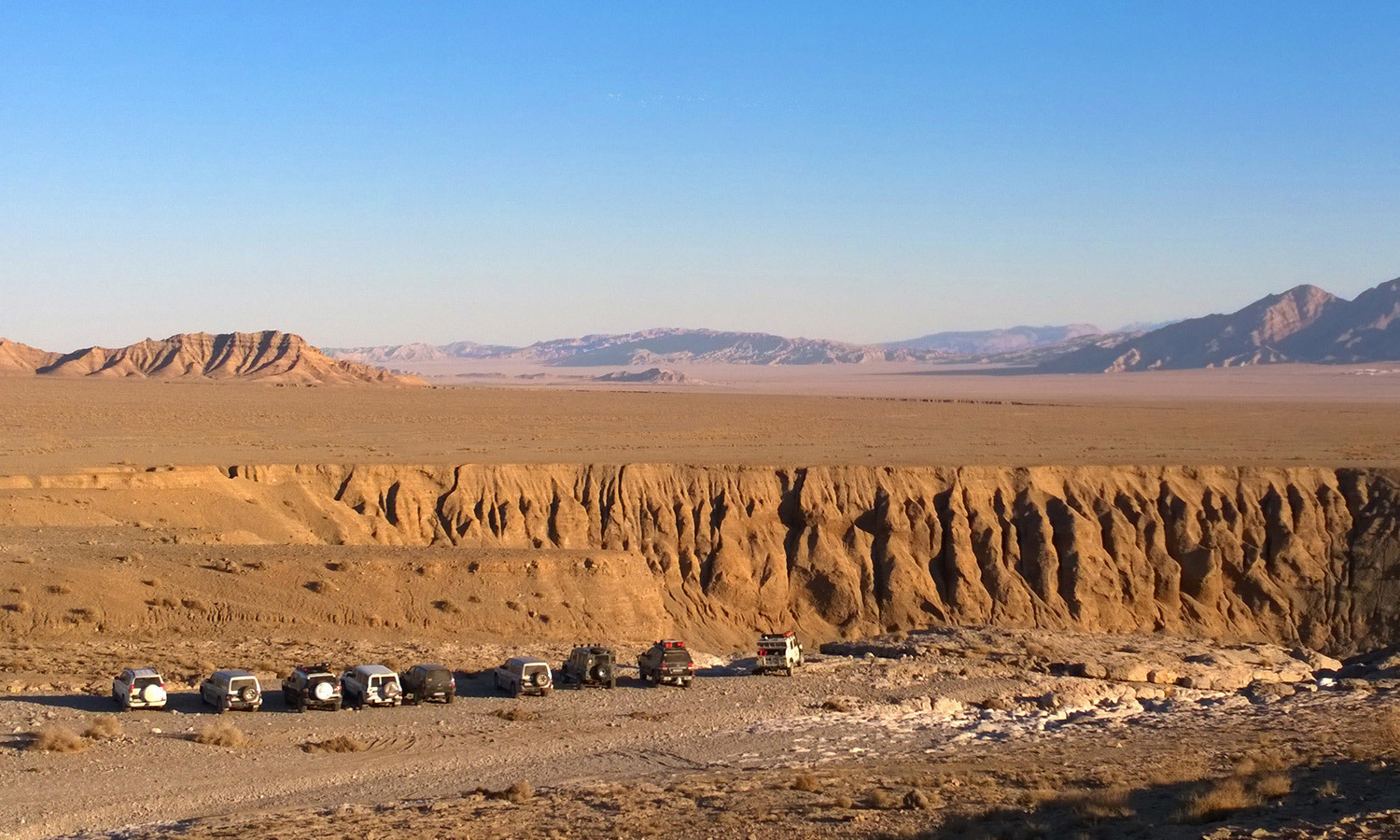
Nain Attraction Spots

Nain lies 170 km north of Yazd, and 140 km east of Isfahan. With an area of almost 35,000 km², Nain lies at an altitude of 1545 m above sea level. Like much of the Iranian plateau, it has a desert climate, with a maximum temperature of 41 °C in summer, and a minimum of -9 °C in winter.

More than 3,000 years ago, Persians learned how to construct aqueducts underground to bring water from the mountains to the plains. In the 1960s, this ancient system provided more than 70 percent of the water used in Iran. Nain is one of the best places in the whole world to see these qanats functioning.

Unique to Nain are some of the most outstanding monuments of Iran: the Jame Mosque, one of the first four mosques built in Iran after the Arab invasion; the Pre-Islamic Narej Fortress; a Pirnia traditional house; the Old Bazaar; Rigareh, a qanat-based watermill; and a Zurkhaneh (a place for traditional sport).

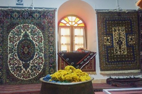
Besides its magnificent monuments, Nain is also famous for high-quality carpets and wool textile and home- made pastry called “copachoo.” Some linguists believe the word “Nain” may have been derived from the name of one of the descendants of the prophet Noah, who was called “Naen”. Many local people speak an ancient Sasani Pahlavi dialect, the same dialect spoken by the Zoroastrians in Yazd today. Other linguists state that the word Nain is derived from the word “Nei” (“straw” in English) which is a marsh plant.

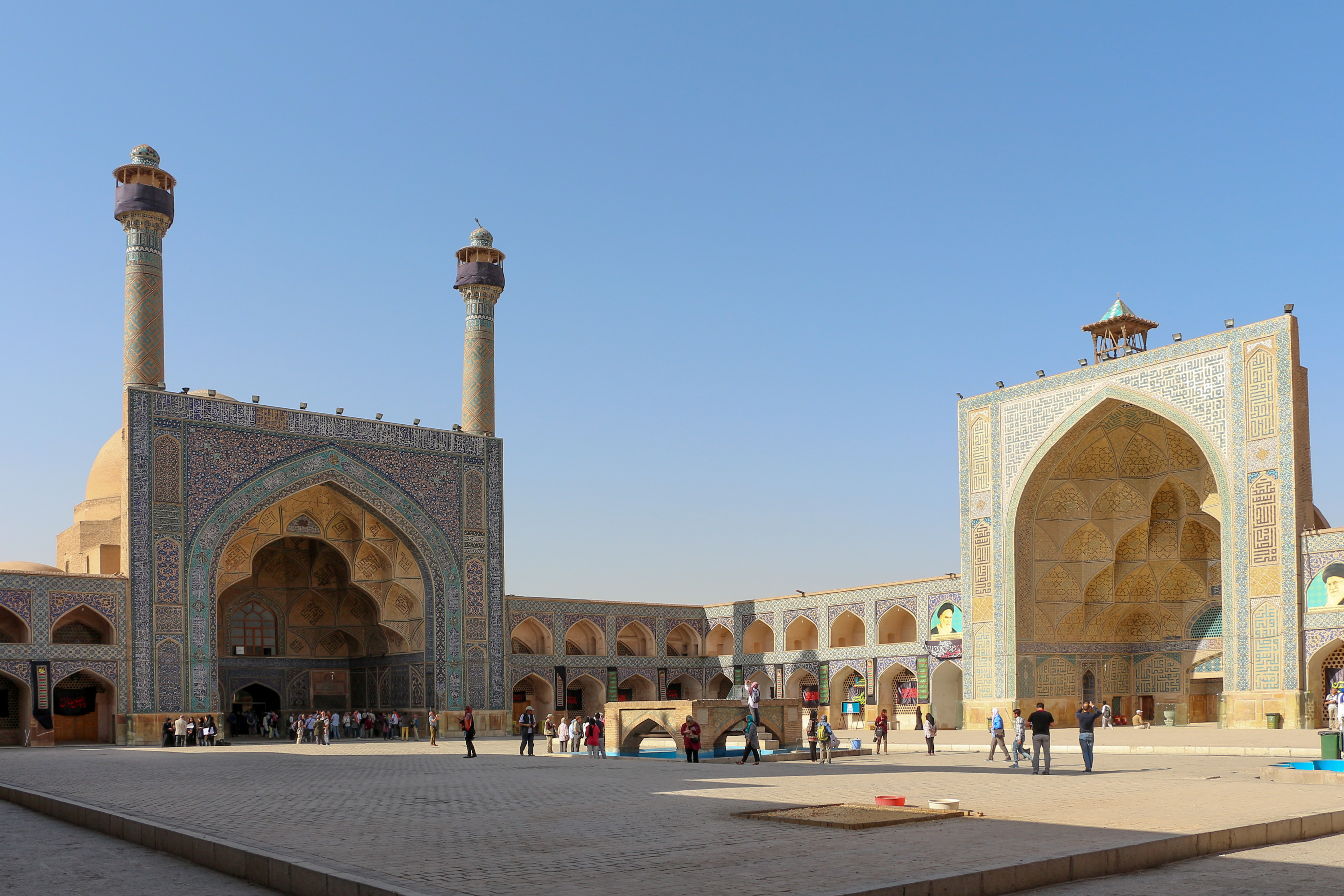
Nain Congregational Mosque

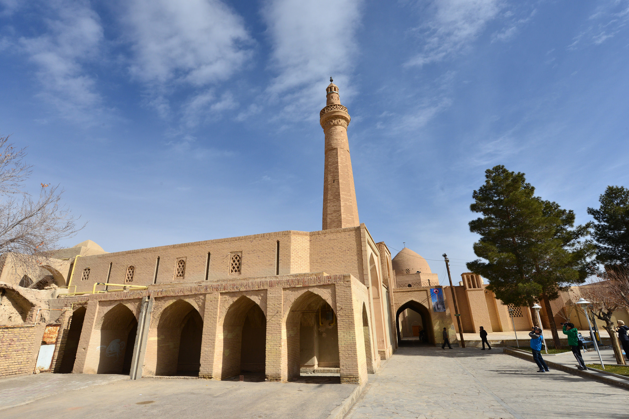
Nain’s congregational mosque is one of the oldest mosques in Iran. But it still has its original architecture and is in use and protected by Iran’s Cultural Heritage Organization. According to the French professor, Arthur Pops, the mosque’s foundation dates back to the 9th century. It has a very simple plan, but very beautiful. The mosque contains a central rectangular courtyard that is surrounded by hypostyles on three sides. At one of these hypostyles, the mihrab of the mosque is located. It is a niche on the wall that shows the direction of “Qebleh” in Mecca, the holy city that Moslems pray toward five times a day. This mihrab has an amazing stucco work decoration, probably created during the 9th or the 10th century. Beside it, there is a wooden altar with delicate wooden inlay work. The Mosque also has a 28-meter-high minaret belonging to the Seljuk Era, the 10th century.

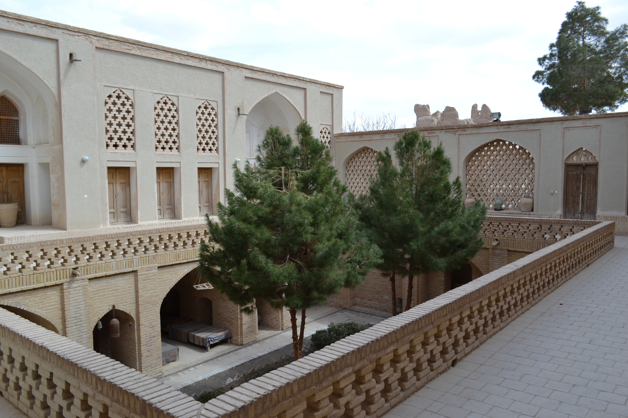
Pirnia Traditional House

Pirnia traditional house and ethnology museum is situated opposite the congregational mosque. A typical example of this region’s desert houses, in terms of architecture and art, belonging to the Safavid Period. The house consists of an exterior, an interior, a deep garden, a silo room and all the facilities of a lord’s house. When you enter the house and pass the first corridor, you reach an octagonal room called “hashti”, a waiting room for visitors. Beautiful paintings, amazing plasterwork of Qur’an stories, a book of famous poems and calligraphy frames decorate the living room. First, the judge of Nain lived there. Then, during the Qajar Period, the governor of Nain lived in this house. Just a few decades ago, the house was purchased by the Ministry of Culture and Art. After renovation in 1994, the house was converted into the desert ethnology museum.

Nain’s Mosallah edifice

Nain’s Mosallah edifice is another must-see. Its vast garden was a popular recreational area until recently. The mausoleum inside the Mosallah was a pilgrimage site for visitors. There is a water reservoir (ab-anbar) on one side of the garden, which can be accessed through a stairway. Water in this reservoir got cooled by two wind towers. It was in use until a few years ago. The architectural style of Mosallah has the characteristics of Qajar dynasty, and a number of literary, political and religious figures are buried at this site. “Mosallah” is an Arabic word for a place of prayer, but no one knows if any praying was ever done at this location. Mosallah is an octagonal mausoleum of dervishes and Qajar and Pahlavi political figures. It’s encompassed by a military fort from Qajar era, with a high wall. The pistachio trees around the turquoise-domed mausoleum and two tall wind towers make the complex really photogenic.
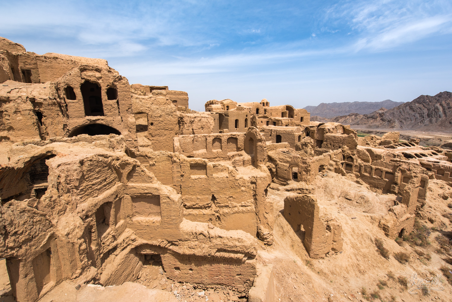
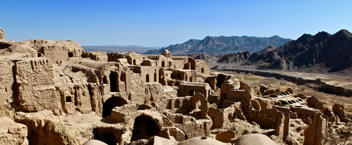
Narin Ghale

Narin Ghal’e is one of the most important monuments of the province dating back to the period before the advent of Islam in Iran, and has been recorded as one of the national buildings. This ancient castle has been constructed on top of Galeen hill and overlooks the city. It seems that upper floors of the building have been reconstructed and belong to the Islamic era. One part of the building was destroyed in the course of road construction during the reign of Pahlavi II.

is one of the most important monuments of the province dating back to the period before the advent of Islam in Iran, and has been recorded as one of the national buildings. This ancient castle has been constructed on top of Galeen hill and overlooks the city. It seems that upper floors of the building have been reconstructed and belong to the Islamic era. One part of the building was destroyed in the course of road construction during the reign of Pahlavi II.

Nain’s bazaar

Nain’s bazaar is a remarkable historical attraction. It extends 340 m from the Gate of Chehel Dokhtaran to Khajeh Khezr mosque, and is connected by main alleys, and tributary passages, to various neighbourhood centers. The bazaar has two main crossroads (chahar su). Parts of it have been renovated, and its many varied stalls were active until a few years ago. However, at present, the bazaar is almost deserted, since the retailers have moved to the city’s street shops. Some important monuments, such as the Sheikh Maghrebi mosque, Khajeh mosque, and Chehel Dokhtaran’s Hosseinieh are nearby.

Fatemi House

Fatemi House is the largest traditional house in Nain. It’s opposite Narin Castle, beside the old bazaar. The house belonged to a very influential family in Nain. It consists of a large number of sections, each with a different function: summer and winter living rooms, resting rooms, stable, silos, corridors, dining rooms for guests, and other facilities. Most of the rooms are furnished with stained glass windows, inlaid wooden doors, and plasterwork. The house belongs to the Cultural Heritage Organization.

Ratepost

Kharanaq is another town in Yazd district. The word Kharanaq means “the Sun’s place of birth”.

Geography of Kharanaq

This deserted and crumbling mud-brick village is situated in a remote valley about 70km north of Yazd in central Iran. The site has been occupied for approximately 4,000 years, while the dilapidated adobe buildings that draw foreigners from around the world dating back to 1,000 years ago. This crumbling mud brick city has been occupied by humans for over 4,000 years. There’s a new town situated 2km from the old one where the remaining residents of Karanaq live. Mostly 400 people save for a few elderly people who refuse to leave, but it is the old town that attracts the attention of visitors and photographers. It is a fascinating place to walk through with its winding and decaying alleys, tunnels and spaces, placed in a picturesque valley.

Kharanaq Texture

Kharanaq is divided into two parts – the old town and the new town. The old town is almost completely deserted, and the new town is where about 130 families continue to live. The old town was constructed with sun-baked mud bricks, forming one of the largest collections of adobe buildings in Iran. The abandoned town is a photographer’s dream with a labyrinth of streets, tunnels, passageways, and rooms, as well as more impressive buildings such as a tiny mosque, a shaking minaret, and an old caravanserai that welcomed merchants and pilgrims centuries ago. It was once a prosperous farming village, but when water supplies dried up the inhabitants left, leaving the town to turn to ruins. In recent years, a new town was constructed within 2km of the ancient town with government-supplied water and electricity. There have existed cities whose population declined. There are the obvious reasons like war and famine, but what else can cause a once vibrant place to decline in population to such an extent that it becomes practically uninhabited? This is a question that rises while exploring the ruins of the abandoned ghost town of Kharanaq.

Less populated & Less known

The reason that Kharanaq was abandoned may have been drought. Once possessing drinking water and fertile farmland, the city lost the entire lifeblood, and people gradually moved to seek opportunities either in Yazd or the mines nearby. Most people started to leave Kharanaq in the 1940s. Until the 1970s there were still some residents who believed the city was worth saving but even those determined stragglers eventually gave up on Kharanaq. Most of the remaining residents are those who are too old and poor to move about. One of the most eye-catching monuments in the city, and one of the few restored buildings is the 15- metre- tall Shaking Minaret of Kharanaq, dating back to the 17th century, frequently vibrating. Nobody knows why. Visitors to Kharanaq quickly learn that the words “watch your step” are very important, as the city is literally crumbling away and many of the surfaces are less than stable. I’m sure that once Iran becomes the popular tourist destination it deserves to be, lots of tourists will go to Kharanaq to see the ancient ghost town, there’s nobody around and you’re free to go wherever you want in the city.

Ratepost

Garmeh

Mesr desert is one of the most beautiful and also one of the hottest deserts in Iran.

Dreamland in desert

If you have the dream of going to a real oasis in the desert, you shouldn’t miss Garmeh, a palm tree clad village with an abundance of water and crops, in the middle of sand plains. A place where you can sit by a well in the shadow of a tree in comlete silence and watch the occasional heard of sheep pass by. That’s exactly what Garmeh is like. Somewhere in Iran’s central desert, Dashte- kavir, lies t

Mesr desert is one of the most beautiful and also one of the hottest deserts in Iran.

his tiny village irrigated by a small mountain spring. Garmeh has been welcoming travelers from all over the world for hundreds of years as it used to be one of the rest spots on the famous silk road.

Hidden Oasis

Garmeh is the capital of Garmeh County in  North Khorasan province. One of the most important monuments of this city is Jalaleddin fortress, which is inherited from Khwarazmian Dynasty. The fortress was established by the command of Jalaleddin Kharazmshah in order to defend it against the Moguls’ attack in the seventh Hijri century. It was built on the top of a hill with a hexagonal foundation. A well exists inside the fortress which seems to be natural. The other monument of this city is Bagh-e-Mazar tomb.

What to do in Garmeh?

During your stay in Garmeh, depending on your time, you can go for a walk among palm trees, relax in a spring or climb the nearest mountain or hill to enjoy the surrounding sceneries.You can also visit other villages nearby like Ordib, Iraj and Dadkin with gardens and mountains, Bayazeh and its castle, Abgarm and its thermal spring.80kms from Garmeh, on the way to Tabas, there’s a salt lake, and 80km from Garmeh to Jandaq you will find Mesr and Farahzad villages and the sand dunes surrounding you.

Mesr desert is one of the most beautiful and also one of the hottest deserts in Iran.

History of Garmeh

The documented history of human settlement in the area dates back to 4000 years ago, but there exists some relatively reliable evidence that suggests human habitation as far back as 7000 years. From about 2000 years ago, the oasis was placed on the Silk Road and therefore, on the main trading route between China and Europe. As a result, many travelers have passed through this area. A famous Persian poet, philosopher and explorer, Naser Khosrow passed through the area about 950 years ago and has mentioned this area in his travel diary. As for well-known European travelers of the recent centuries, we can mention Seven Hedin and Alfonse Gabriel, who visited Garmeh in the last century.

The town’s only water source, close to the heart of the village, is the only source of life for the gardens and Date Palm orchards that make this oasis such a special place. The main activity for the natives during this incredibly long period had been some form of agriculture and animal husbandry in unforgiving conditions that are the reality of this land.

Garmeh

Don’t miss photography!

This picturesque village also has many attractions which makes it a popular spot for so many tourists from all over the world. There are beautiful palm trees in the southern flank of the village. The weather is great in spring, fall and winter. There is an old four-floor citadel in Garmeh which dates back to the Sassanid period and has been attracting so many archeologists.

The eye-catching alleys of Garmeh which are decorated with beautiful Sabbats attract so many filmmakers to Garmeh. Garmeh lakes are the habitat for ducks in spring and winter and the hills are home to partridges.

There is a natural spring which has been flowing for thousands of years and creates a good ecosystem for different types of small fish. There are elephant-like mountains around with red soil containing iron. Its pleasant silence and the starry nights, along with the sound of water and the movement of palm trees, attract lots of tourists from all over the world to this area.

Handicrafts of Garmeh are mostly created out of palm leaves which is a good souvenir for international tourists. The residents of Garmeh speak Pahlavi language which is the oldest language in Iran. The Mesr Desert, near Garmeh, attracts lots of tourists every year. There is also a thermal spring near Garmeh which has many therapeutic benefits and is useful in treating Arthritis.

Ratepost

Chak Chak  the Zoroastrian Fire Temple

Not far from Yazd is the Zoroastrian sanctuary of Chak-Chak. Although Zoroastrianism arose in eastern Iran, now followers number only about. 10,000 people and Muslims call them infidels. Most of the temples were destroyed, but those that remained, are of great interest to tourists.

Short History Zoroastrianism 

Zoroastrianism, or Mazdeism, a religion founded in the 8th or 7th c. BC. reformer of an ancient Iranian religion called Zarathustra. The religion of Zoroastrianism continues to exist until today. In Iran, its followers total only approx. 10,000 people and Muslims call them gabaras (“infidels”). Today, the community of Zoroastrians (zartoshti) is mainly parses of India and the United States. Small communities are scattered all over the world – Iran, Azerbaijan, Tajikistan, Canada, Turkey, Afghanistan.

Chak Chak Location

Although on the maps Chak-Chak is marked as a village, nobody really lives there, except the guard and rare pilgrims on ordinary days. Only during religious holidays, many Zoroastrians from all over the world come here. Located Chak-Chak in 43 kilometers from Ardakan – a small historical town, located on the road Yazd-Tehran. Getting to the sanctuary is not very simple – the flow of cars there is extremely small, most often there are taxis carrying local and foreign tourists. Near Ardakan, you can also see the Zoroastrian towers of silence.

Zoroastrian Temple

To the temple of Pir-e Sabz, cut down in the thickness of the mountain, there are 320 steps. In Pir-e Sabz, the fire burns and the holy spring beats. According to legend, the appearance of a spring in this place is connected with the escape from the Arab invasion of the Sassanid princess Nikban. Thirsting in the desert, Nikbana followed the order of Ahura Mazda and threw her staff to the ground. Where she did this, she scored a stream. By the way, the name of the Chak-Chak complex came from the sound of drops falling to the floor.

In Zoroastrian temples, called Persian “atashkade” (lit. house of fire), an unquenchable fire burns, the ministers of the church watch around the clock, so it does not go out. There are temples in which fire burns for many centuries. The family of the mobs, to whom the sacred fire belongs, fully carries all the costs of maintaining the fire and its protection and does not materially depend on the help of the bekhdins. The decision to establish a new fire is taken only if the necessary funds are available.

OLYMPUS DIGITAL CAMERA

The Moors are guardians of sacred lights and are obliged to protect them in all accessible ways, including with weapons in their hands. This probably explains the fact that after the Islamic conquest Zoroastrianism quickly declined. Many of the mobs were killed defending the lights.

Zoroastrians attach great importance to rituals and ceremonies. The main feature of the Zoroastrian rituals is the struggle against any impurity, material and spiritual. The sacred fire plays an extremely important role in Zoroastrianism, for this reason the Zoroastrians were often called “fire worshipers”, although the Zoroastrians themselves consider this name insulting. They claim that fire is only the image of God on earth.

The Zoroastrian holiday Navruz is still a national holiday in Kazakhstan (Nauryz), Azerbaijan (Novruz), Tajikistan, Uzbekistan, Turkmenistan and the Russian Federation.

Ratepost

8 reasons for Rafting in Iran
Rafting is one of the new sports in Iran that has found many enthusiasts in recent years and the regular boat ride program is provided by the tourist agencies.
Although Iran is a country that is located in a desert and dry area,but the special geographic location and the high mountain range of Iran have led to the creation of rivers in various parts of Iran.
If you are looking for adventures during your trip to Iran, Rafting in Iran is one of the best options available. In addition to all tourist activities, Rafting in Iran gives you the opportunity to have a real thrill. It is one of the popular water sports in Iran.The months of April, May, and June are considered the best times to take part in Rafting in Iran. There are many rivers that are ideal for rafting in Iran.

8 reasons for Rafting in Iran

There are several reasons why the program of Rafting in Iran turns into one of the attractions of traveling to Iran

Iran is cheap
According to the latest World Economic Organization, Iran ranked first in the world’s cheapest among 144 countries.
According to this report, Iran ranked 66.6, has the most suitable competitive position with other countries.So Iran is one of the cheapest destinations for tourists.

Is it  safe to visit  Iran?

All headlines on news and media are very different from what travelers face and experience in Iran. The US government and most Western countries have a long travel warning for Iran. Although I do not advise you to ignore this warning, I advise you to balance it with direct accounts of Americans and many other travelers who have recently visited the country. The country is beautiful, the story is rich and people are eager to demonstrate their almost sacred commitment to hospitality.
The best way to get the answer is to ask travelers who have visited Iran, we encourage you to visit and join our face book page, LinkedIn, twitter.

8 reasons for Rafting in Iran

Excitement and history Simultaneous  with each other
Some rivers for rafting are located in the provinces and historic cities of Iran, with many historical and ancient features such as Zayanderoud river in Isfahan province or Cesar river in Kurdistan province.
In these areas, you will not only enjoy water sports but also visit the historical monuments of these cities like historical mosques,Palaces, Castles, Caravansaries and other sights with hundreds of years of history.

Pristine landscapes along the riverside
There are several Rafting rivers in Iran, Parts of these rivers flow through woody and mountainous areas which have created unique features for tourists and athletes.
Sections of the northern rivers flow through the 4,000,000-year-old Hirkani forests, also, the western rivers of Iran pass through the Alborz Mountains, that beautiful mountainous scenery is very attractive.Also, the rivers of the Central Plateau of Iran in the province of Chahar Mahal and Bakhtiari not only provide you beautiful nature, but the ancient history is also attached to this part of Iran.

8 reasons for Rafting in Iran

Different rivers with various classification

Although Iran is located in a desert region, the presence of different mountains in the north and west of Iran has created a different face of them.
In these areas, roaring permanent rivers have provided special conditions for those who like these sports.There are different rivers for rafting and riding in Iran, but among them, 14 rivers have rafting conditions.They range from class 1 to 5.

Dispersion of the river in Iran
In some countries, certain areas are specified for rafting.But due to the special geographic features in Iran, various areas throughout Iran are suitable for rafting, White water rafting, Canoeing and etc.
So you can take a boat ride on the whole northern part of Iran or from the East to the West in the Alborz Mountains as well as from north to south-east of Iran along the Zagros Mountains.

8 reasons for Rafting in Iran

Modern facilities
Rowing programs are regularly carried out in the rivers of Iran, which increases the youth’s attention to this sport.Accordingly, the facilities and equipment needed for this are prepared, which is part of the necessity of these programs by the agencies.
These equipment are divided into two categories: Individual and group
Individual travels or Day Trip, are single or families traveler to these areas, and their facilities included: experienced guides, Water Cag, Life Jacket, Helmet, Neoprene Boots & Wetsuit.But the groups or Expedition, and the tourist who come for some days rafting have more as like as:Paddle Raft, Cargo Raft,Slalom,Sprint,Downriver, Kayak,Rescue/Safety Kayak,Race Kayak,Different Tent,First Aid,Canopy,Mobile kitchen,4WD Off-road cars,and more.

Professional Agencies
There are a large number of reputable agencies in the field of nature tours and White Water Rafting that offer the best types of tourist services and amenities required by travelers.

Ratepost


Iran’s Economuseum becomes a major tourist attraction
An ancient building in southeastern Iran has become a museum of traditional professions that attracts a large number of visitors.

A historic school in the city of Kerman, in southeastern Iran, has been restored and renovated and renamed “Economuseum”. It is a place where visitors can familiarize themselves with the different traditional professions of the city.

For starters, the Grand Bazaar of Kerman has numerous attractions. Anyone entering the market can spend hours visiting the historical monuments there, including old small workshops. Old men have still kept alive and probably forgotten professions in the province.

According to a Persian report from the Mehr News , one of the ancient monuments in the main hall of the bazaar was recently restored.

Visitors can now see for themselves the traditional professions of Kerman people there. Each camera is dedicated to a certain art and industry. Ceramics, carpet weaving, carpet weaving and a room with symbolic decoration suggesting that Kermanis decorate the rooms of their houses. A public road in the monument is going to be adapted and put into service, too. This place is known as the Lady Bibijan School. The building was opened to the public in 2015 as the Econonomuseum of Professions, which houses visitors and tourists.

The historic building built in 1888 was first used as a joint Iran-UK bank. Later, after the bank was transferred to the British consulate, the building was renovated in 1933 for use by students. In 1941, it was named after the lady “Bibi Hayati”, and was used as a school until 1977. It was then abandoned and extinguished. And several years ago, it was restored and converted into a museum.


Ratepost

The Dasht-e Kavir, is one of two deserts dominating the region’s landscape, is a mix of sand and salt as blinding in its whiteness as it is deafening in its silence. Dasht-e Kavir, is also known as “Kavir-e Namak” and “Great Salt Desert”, is a large desert lying in the middle of the Iranian plateau, around 300 kilometers east-southeast of Tehran. Dasht-e-Kavir desert is approximately 800 kilometers long and 320 kilometers wide, and composed of mud and salt marshes. Millions of years ago, this region was occupied by a salt-rich ocean that covers a small piece of continent in what is now central Iran. As the time passes, the ocean gets dried up, it left behind a layer of salt as much as 6 to 7 kilometers thick.

Therefore, over the time, the layer of salt was buried under a thick layer of mud; however salt has a fairly low density lower than the layer of mud and rocks underneath which the salt layer lay. So it taking place pushing up through the overlying sediment and finally, over millions of years, the salt broke through and formed domes. The salt domes of Dasht-e Kavir are probably some of the best examples of this geological marvel. Thus, geologists have recognized about 50 large salt domes in this region. Some of the domes have been eroded away by wind and rain exposing its cross-section.

Dasht-e Kavir

However, the desert climate is arid and receives little rain and snow each year, but the surrounding mountains on all side, provide plenty of runoff to create vast seasonal lakes, marshlands and playas. Temperatures can reach 50 °C in summer, and the average temperature in January is 22 °C. Though it looks like a firm surface, the salt crust is only a few inches thick, below which lies soft grease-like mud the Iranians called “Charbeh” that is really difficult to get out of if one were to get stuck. Due to arduous travelling to Dasht-e Kavir, it is very dangerous. The soil is sterile and not appropriate for cultivation. In summer the hot temperatures cause extreme vaporization, which leaves the marshes and mud grounds with large crusts of salt. Heavy storms frequently occur and they can cause sand hills reaching up to 40 m in height. Some parts of Dasht- e Kavir have a more steppe-like appearance.

Dasht-e-Kavir desert is almost uninhabited and only partly explored. Wild sheep, camels, goats and Persian leopards also live in the mountainous areas. Hence, human settling is restricted to scattered oases, where wind-blocking housing constructions are raised to deal with the tough weather conditions. Some live in the hills and the surrounding mountains. Against the odds, oases exist within these desolate environs, home to villages that are sustained by the wells of sweet water that have been part of desert mythology for centuries. Vegetation in the Dasht-e Kavir is adapted to common plant species like shrubs and grasses can only be found in some valleys and on mountain tops. So, the most widespread plant is mugwort. The Persian ground jay is a bird species living in some parts of the desert plateaus, along with Houbara bustards, Persian gazelles, camel, goats, leopards, larks and sandgrouses.

Moreover night life brings on wild cats, wolves, foxes, and other carnivores, the Persian onager and Asiatic cheetah can be seen. Lizards and snakes live in different places in the central plateau. The extreme heat and storms in Dasht-e Kavir cause extensive erosion, which makes it almost impossible to cultivate any lands almost uninhabited and knows little exploitation. Camel and sheep breeding and agriculture are the sources of living to the few people living on its soil. For irrigation, Iranians developed a sophisticated system of water-wells known as qanats. These are still in use, and modern globally used water-revenue systems are based on their techniques.


Dasht-e Kavir, or the Great Salt Desert National Park, is a large desert lying in the middle of the Iranian plateau about 300 kilometers east-southeast of Tehran. A total surface area of about 77,600 km2 makes it the Earth’s 26th largest desert. This desert stretches from Alborz mountain range in the north-west to Dasht-e- Lut in the south-east and is partitioned between the Iranian provinces of Khorasan, Semnan, Tehran, Isfahan and Yazd. This amazing desert is about 800 kilometers long, and more than 320 kilometers wide, and composed of mud and salt marshes. Tens of millions of years ago, this region was occupied by a salt-rich ocean that surrounded a small piece of continent in what is now central Iran. As the ocean dried up, it left behind a layer of salt as much as 6 to 7 kilometers thick. Over time, the layer of salt was buried under a thick layer of mud. But salt has a fairly low density, lower than the layer of mud and rocks underneath. So it started pushing up through the overlying sediment and eventually, over millions of years, the salt got out and formed domes. The salt domes of Dasht-e-Kavir are probably some of the best examples of this geological phenomenon.

Dasht-e Kavir’s climate is arid and receives little rain and snow during the year. However, the surrounding mountains on all sides provide plenty of runoff to create vast seasonal lakes, marshlands and playas. Temperatures can reach 50 °C in summer, and the average temperature in January is 22 °C. Day and night temperatures during a year can differ up to 70 °C. Rain usually falls in winter.

The desert soil is covered with sand and pebbles. There are marshes, seasonal lakes and seasonal river beds. The hot temperatures cause extreme vaporization, which leaves the marshes and mud grounds with large crusts of salt. Heavy storms frequently occur and they can cause sand hills reaching up to 40 m in height. Some parts of Dasht-e-Kavir have a more steppe-like appearance.

Geologists have identified about 50 large salt domes in this region some of which have been eroded away by wind and rain exposing its cross-section.

Although it looks like a hard surface, the salt crust is only a few inches thick, below which lies soft grease-like mud that Iranians call “Charbeh”, which is extremely difficult to get out of if one gets stuck in. Due to this fact, travelling in Dasht-e-Kavir is extremely dangerous. The soil is sterile and not suitable for cultivation. The desert is almost uninhabited and only partly explored. Human settling is restricted to scattered oases, where wind-blocking housing constructions are raised to deal with the harsh weather conditions. Some live in the hills and the surrounding mountains. Wild sheep, camels, goats and Persian leopards also live in the mountainous areas.

Ratepost

Introduction of Kermanshah

As the capital of Kermanshah province, it’s situated in western Iran. Kermanshah is the principal city in this region, and also one of the tourist Attractions in Iran. With an altitude of about 1200 m above sea level, it has a moderate and mountainous climate. According to 2006 census, the population of this city was about 950400. The language mostly spoken in Kermanshah is Kurdish.

The average annual precipitation and relative humidity in this region is to the extent that mountain slopes and plains are mainly covered with woods and pastures, and in some areas dry farming is applied. The average annual temperature is about 14 C there.

Lying within the Zagros chain, and providing natural shelters and caves were the reasons which made Kermanshah a proper settlement for humans in Stone Age. Archaeological excavations prove that prehistoric people used to occupy this area. The discovered objects dates back to at least 200000 years ago.

A major part of the city’s prosperity depends on agriculture. But there are also some other factors like food processing, constructional materials, and local handicrafts like kilim or carpet weaving, cotton-shoe making (Giveh), leather works, etc. Kermanshah is a center of Iranian and Kurdish traditional music. It’s been the homeland of prominent figures in literature, art, history, science, and politics.

Major industrial installations in this city include sugar refinery factories, oil refinery, petrochemical complex, cement factory, and a citric acid plant which is the only one throughout the Middle East.

This city is also well-known because it’s related to a legendary Persian love story. The story narrates a tragic romance between Khosrow II (the last king of Sassanid Empire), Shirin (Khosrow’s lover), and Farhad (a stonemason who was in love with Shirin).

This city has a lot to offer as a tourist attraction.

Kermanshah

History of Kermanshah

Pre-Islam Era

Kermanshah has been always the link between Iranian plateau and the Mesopotamia throughout its history. In the fourth millennium BC, the region currently known as Kermanshah province, was one of the most important centers of trade and commerce with Mesopotamia. There were also many conflicts and wars between these two nations. Therefore, this region used to be the center of various Iranian and Mesopotamian civilizations and governments for centuries.

During Buyid period, some miner Kurdish dynasties rose in the areas around Kermanshah. It had a military and economic importance in Saljuq period. The reason was its location at the intersection of a great highway linking the city to major trade areas inside and outside of the Iranian Plateau. And, it was one of the major cities as well as one of the dynastic capitals in Sassanid period. This glorious city was also the summer resort for Sassanid kings.

Post-Islam Era

In 640 A.D., after the Arab invasion of Iran, Kermanshah was occupied and destroyed completely by Arabs. The population decreased, and its residents moved to another city. About a decade later, people rebuilt the city at the bank of Qarasu river.

During the reign of Abbasid caliphs, it was an important city because of its strategic location. In 1220 A.D., after Mongol invasion of Iran, Kermanshah was badly damaged again.

  • Safavid Period

In the early Safavid period, due to Iran’s conflicts with Ottoman, ruling Kermanshah was a complicated situation. At times, Ottomans could defeat Iranians and rule over the city. But some other times, they were defeated by Iranians and left its ruling to Iran. But from the reign of Shah Safi, the sixth king of Safavid dynasty, to the end of Safavid period, the city was enjoying a period of peace and prosperity.

  • Afsharid Period

Benefiting from artillery attributed to Nader Shah, the founder of Afsharid dynasty, Kermanshah gained a military significance. Such condition made the city a battlefield between Nader Shah and Ottomans.

Because of its artillery, Kermanshah was the focus of attention after the death of Nader Shah. There were many conflicts over the takeover of the city among those who sought power, and it was Karim Khan Zand, the founder of Zand dynasty, who won.

  • Zand Period

In 1753 A.D., Karim Khan invaded Kermanshah, destroyed and evacuated it completely so that, for nearly 10 years, there was nothing called Kermanshah. Then, in 1762 A.D., the city was revived in the southwest of the former location, and Allahqoli Khan (from Zanganeh family, a local Kurdish tribe) ruled there as the governor.
Kermanshah enjoyed a short period of peace due to having Allahqoli Khan as its most powerful governor. But after the death of Karim Khan, he claimed the throne, and this led the city toward civil conflicts once again. Throughout Zand period, Zanganeh family governed Kermanshah most of the time.

  • Qajar Period

In 19th century, Kermanshah experienced a progress in terms of commercial and strategic significance. The city was flourishing. It also had a political and social importance to the government.

The appointment of Mohammad Ali Mirza, the sixth king-to-be of Qajar dynasty, as the governor of Kermanshah was one of the best things happened to the city. He started urban planning and caused the city to develop greatly. For instance, he Constructed caravansaries and accommodations for merchants, and build a new fortress.

There were two major reasons which made Kermanshah a critical area for The Qajars. First, their relationship with Ottomans in Iraq. And second, making it secure for the pilgrims so that they could go to Iraq and visit the Shiite’s shrines there. Qajar kings managed to restore relative security in this region.

  • Contemporary Period

Kermanshah played an important role in Constitutional Revolution in Iran. It was a movement from 1905-1911 for establishing a constitutional regime in which the people of this city were actively involved.

In the late World War I, Kermanshah was seized by Ottoman Forces. Also, during World War II, Great Britain forces seized the city and it remained occupied until the end of the war.

Kermanshah played a major role in Islamic Revolution of Iran in 1979 as well. It was one of the resistance centers against Pahlavi regime. It was among the cities of Iran which underwent a lot of damage during the eight-year war of Iran and Iraq (1980-1988).

Takieh_Mo'aven_ol-Molk

Ratepost

Bistoun’s inscription at Bisotun – which dates to 522 BCE, lies some 1300 meters high in the mountains. The site is a UNESCO World Heritage site and has been attracting visitors for centuries. The Behistun inscription is in old Persian cuneiform. What the Rosetta Stone is to Egyptian hieroglyphs: the trilingual inscription (in Old Persian, Elamite and Akkadian) was crucial in the decipherment of the script. The relief above the inscription depicts Darius facing nine rebels who objected to his crowning. At the king’s feet lies Gaumata. The location of this important historical document is not coincidental: Gaumata, a usurper who is depicted as lying at Darius’ feet, was a Medean and in Achaemenid times Behistun lay on the Medea-Parsa highway. Behistun is also notable for three reliefs at the foot of the hill that date from the Parthian era. Among them is a Hellenistic-era depiction of the divinity Bahram as the Greek hero Hercules, who reclines with a goblet in his hand, a club at his feet and a lion-skin beneath him. Because it lies on the route of an ancient highway, this life-size rock sculpture may reflect Bahram’s status as patron divinity of travelers.

Taghe Bostam The rock reliefs at Taq-e Bostan lie four miles north-East of Kermanshah, where a spring gushes from a mountain cliff and empties into a large reflecting pool. One of the more impressive reliefs, inside the largest grotto (ivan), is the oversized depiction of Sassanid king khosrey the second (591-628 CE), who appears mounted on his favorite charger, Shabdiz. Both horse and rider are arrayed in full battle armor. There are two hunting scenes on complementary sides of the ivan: one depicts an imperial boar hunt and the other depicting the king stalking deer. Elephants flush out the boar from a marshy lake for the king who stands poised with bow and arrow in hand while he is serenaded by female musicians following in other boats. These royal hunting scenes are narrative murals in stone are count among the most vivid of all Iranian rock reliefs. The Taq-e Bostan reliefs are not limited to the Sassanid era. An upper relief depicts the 19th century Qajar king Fath-Ali shah holding court.

Ratepost

Ahwaz Visiting Places

Chogha Zanbil is an ancient Elamite complex in the south of Iran. It is one of the few existent Ziggurates outside of Mesopotamia. Choga Zambil means ‘basket mound.’ It was built about 1250 BC by the king Untash -Napirisha, mainly to honor the great god Inshshinak. Its original name was Dur Untash, which means ‘town of Untash’, but it is unlikely that many people, besides priests and servants, ever lived there. The complex is protected by three concentric walls which define the main areas of the ‘town’. The inner area is wholly taken up with a great ziggurat dedicated to the main god, which was built over an earlier square temple with storage rooms also built by Untash-Napirisha. The middle area holds eleven temples for lesser gods. It is believed that twenty-two temples were originally planned, but the king died before they could be finished, and his successors discontinued the building work. In the outer area are royal palaces, a funerary palace containing five subterranean royal tombs.

Although construction in the city abruptly ended after Untash-Napirisha’s death, the site was not abandoned, but continued to be occupied until it was destroyed by the Assyrian king Ashurbanipal in 640 BC. Some scholars speculate, based on the large number of temples and sanctuaries at Chogha Zanbil, that Untash-Napirisha attempted to create a new religious center (possibly intended to replace Susa) which would unite the gods of both highland and lowland Elam at one site.The ziggurat is considered to be the best preserved example in the world. In 1979, Chogha Zanbil became the first Iranian site to be inscribed on the UNESCO WORLD HERITAGE SITE.

Tomb of Daniel is the traditional burial place of the biblical prophet Daniel. Various locations have been named for the site, but the tomb in Susa, Iran, is the most widely accepted, it being first mentioned by Benjamin of Tudela, who visited Asia between 1160 and 1163.The Book of Daniel mentions that Daniel lived in Babylon and may have visited the place of Susa‌, Iran, but the place where he died is not specified; the tradition preserved among the Jews and Arabs is that he was buried in Susa. Today the Tomb of Daniel in Susa is a popular attraction among local Muslims and Iran’s Jewish community alike.

The earliest mention of Daniel’s Tomb published in Europe is given by Benjamin of Tudela who visited Asia between 1160 and 1163. In the fa’ade of one of its many synagogues he was shown the tomb assigned by tradition to Daniel. Benjamin declares however, that the tomb does not hold Daniel’s remains, which were said to have been discovered at Susa about 640 CE. The remains were supposed to bring good fortune: and bitter quarrels arose because of them between the inhabitants of the two banks of the choaspes River. All those living on the side on which Daniel’s grave was situated were rich and happy, while those on the opposite side were poor and in want; the latter, therefore, wished the bier of Daniel transferred to their side of the river. They finally agreed that the bier should rest alternately one year on each side.

This agreement was carried out for many years, until the Persian shah Sanjar, on visiting the city, stopped the practise, holding that the continual removal of the bier was disrespectful to the prophet. He ordered the bier to be fastened with chains to the bridge, directly in the middle of the structure; and he erected a chapel on the spot for both Jews and non-Jews. The king also forbade fishing in the river within a mile of Daniel’s bier.[2] According to Benjamin, the place is a dangerous one for navigation, since godless persons perish immediately on passing it; and the water under the bier is distinguished by the presence of goldfish.

Shushtar is an ancient fortress city in the khuzestan province in southwestern Iran. It is approximately 92 km away from Ahwaz. In the Elamite times Shushtar was known as Adamdun. In the Achaemenian times its name was Å urkutir. The modern name, Shushtar, is connected with the name of another ancient city, Susa, and means “greater (or better) than Shush.” During the Sassanian era, it was an island city on the Karun river and selected to become the summer capital. The river was channelled to form a moat around the city, while bridges and main gates into Shushtar were built to the east, west, and south. Several rivers nearby are conducive to the extension of agriculture; the cultivation of sugar cane, the main crop, dates back to 226.

A system of subterranean channels called Ghanat, which connected the river to the private reservoirs of houses and buildings, supplied water for domestic use and irrigation, as well as to store and supply water during times of war when the main gates were closed. Traces of these ghanats can still be found in the crypts of some houses. The ancient fortress walls were destroyed at the end of the Safavid era.The Band -e -Kaisar was a Roman arch bridge, and the first in the country to combine it with a dam. When the Sassanian Shah Shapur the first defeated the Roman emperor Valerian, he is said to have ordered the captive Roman soldiers to build a large bridge and dam stretching over 500 metres. Lying deep in Persian territory, the structure which exhibits typical Roman building techniques became the most eastern Roman bridge and Roman dam.

Its dual-purpose design exerted a profound influence on Iranian civil engineering and was instrumental in developing Sassanid water management techniques. The approximately 500 m long overflow dam over the Karun, Iran’s most effluent river, was the core structure of the Shushtar Histoical Hydraulic Systems, a large irrigation complex from which Shushtar derived its agricultural productivity, and which has been designated World Heritage Site by the UNESCO in 2009.

Ratepost